Area Overview for CA6 5SY
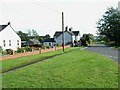
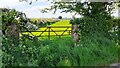
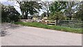
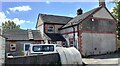
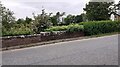
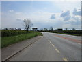
Photos of CA6 5SY


Area Information
CA6 5SY is a small residential postcode in Cumbria, England, encompassing parts of Longtown and Easton. With a population of 1,606 and a low density of 17 people per square kilometre, it reflects a rural, spread-out community. The area is historically rooted, bounded by the River Esk and River Lyne, and part of the ancient parish of Arthuret. Longtown, the main settlement, serves as a market town with a mix of agricultural and historical industries. Daily life here is shaped by its rural character, with a focus on local amenities and a strong connection to the surrounding landscape. The postcode area includes a blend of houses, many of which are owner-occupied, and is accessible via the A7 road and Gretna Green Railway Station. While the area lacks large urban conveniences, its proximity to natural features and historical sites, such as Netherby Hall, offers a distinct charm. For those seeking a quieter, community-oriented lifestyle, CA6 5SY provides a blend of practicality and heritage, though its small size means services are limited to nearby towns.
- Area Type
- Postcode
- Area Size
- Not available
- Population
- 1606
- Population Density
- 17 people/km²
The property market in CA6 5SY is characterised by high home ownership (73%) and a predominance of houses. This suggests a community where long-term residency is common, with properties likely to be family homes rather than investment properties or rental units. The area’s small size and low population density mean the housing stock is limited, with fewer options available compared to larger towns. Most properties are likely to be traditional houses, reflecting the area’s rural and historical character. For buyers, this implies a market where properties are not frequently available, and competition may be limited. The focus on owner-occupation also means that rental opportunities are scarce, making CA6 5SY more attractive to those seeking a place to settle rather than a short-term investment. Proximity to Longtown and its amenities may influence property values, though the small postcode area means buyers must consider nearby towns for additional services.
House Prices in CA6 5SY
Showing 2 properties
| Address | Type | Beds | Baths | Last Sale Price | Last Sale Date | |
|---|---|---|---|---|---|---|
| Workshop At Tomaru, Sandysike, Road Leading From Bush On Lyne Junction West To Cliff Road, Longtown, CA6 5SY | Industrial | - | - | - | - | |
| Unit 2 Millicans Yard, Sandysyke, Road Leading From Bush On Lyne Junction West To Cliff Road, Longtown, CA6 5SY | warehouse | - | - | - | - |
Energy Efficiency in CA6 5SY
Living in CA6 5SY offers a lifestyle centred on rural simplicity and local amenities. The area is within practical reach of five retail outlets, including Spar, Spar Longtown, and Asda Carlisle, providing essential shopping options. The Gretna Green Railway Station connects residents to nearby towns, though services are likely limited to key routes. The area’s character is defined by its historical and natural features, such as the parish church of St Michael and the River Esk, which contribute to a sense of place. While the postcode lacks large-scale leisure facilities, its proximity to Longtown and surrounding countryside offers opportunities for outdoor activities. The small population and low density mean a close-knit community, with daily life revolving around local traditions and the pace of rural living. For those who value convenience over urban vibrancy, CA6 5SY provides a balance of practicality and tranquillity.
Amenities
Schools
| Rank | School | Type | Entry gender | Ages |
|---|
Explore more schools in this area
Go to Schools tabDemographics
The population of CA6 5SY has a median age of 47, with the majority of residents aged between 30 and 64 years. This suggests a mature, stable community with a focus on established households. Home ownership is high at 73%, indicating a strong presence of long-term residents rather than renters. The area is predominantly composed of houses, reflecting a residential profile that prioritises family homes over flats or apartments. The predominant ethnic group is White, though no specific diversity statistics are provided. The low population density of 17 people per square kilometre underscores the rural nature of the area, where housing is spread out rather than concentrated. This demographic profile aligns with a community that values privacy, stability, and a connection to the land. For buyers, this suggests a market skewed towards owner-occupied properties with a focus on traditional housing stock, rather than newer developments or rental-focused schemes.
Household Size
Accommodation Type
Tenure
Ethnic Group
Religion
Household Composition
Age
Household Deprivation
NS-SEC
Explore more demographic insights in this area
Go to Demographics tabPlanning
Planning Constraints
- Flood RiskPremium
- Ramsar Wetland SitesPremium
- Area of Outstanding Natural BeautyPremium
- Protected Nature ReservePremium
- Protected WoodlandPremium