Area Overview for CA4 0NB
Photos of CA4 0NB
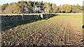
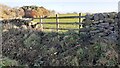
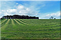
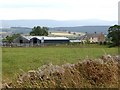
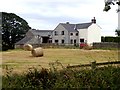
13 photos from this area
Area Information
Key information about the CA4 0NB including its size, population, and administrative classification.
- Area Type
- Postcode
- Area Size
- 2.2 km²
- Population
- 1888
- Population Density
- 39 people/km²
House Prices in CA4 0NB
9
Properties
£346,000
Average Sold Price
£205,000
Lowest Price
£434,000
Highest Price
Showing 9 properties
| Address | Type | Beds | Baths | Last Sale Price | Last Sale Date | |
|---|---|---|---|---|---|---|
| South Lodge, Access Road To Sceugh, Southwaite, CA4 0NB | Land | - | - | £205,000 | Jun 2017 | |
| Cobble Dyke, Colt Close And Sceugh Head On The U 3035, Southwaite, CA4 0NB | Bungalow | - | - | £425,000 | Aug 2016 | |
| Woodlands, Colt Close And Sceugh Head On The U 3035, Southwaite, CA4 0NB | Bungalow | 4 | 2 | £320,000 | Apr 2013 | |
| Inglewood, Colt Close And Sceugh Head On The U 3035, Southwaite, CA4 0NB | Detached | - | - | £434,000 | Feb 2007 | |
| Colt Close Farm, Colt Close And Sceugh Head On The U 3035, Southwaite, CA4 0NB | Office | 4 | 2 | - | - | |
| Sceugh Head, Colt Close And Sceugh Head On The U 3035, Southwaite, CA4 0NB | Semi-detached | - | - | - | - | |
| Sceugh Hill, Colt Close And Sceugh Head On The U 3035, Southwaite, CA4 0NB | Detached | - | - | - | - | |
| High Trees, Colt Close And Sceugh Head On The U 3035, Southwaite, CA4 0NB | Detached | - | - | - | - | |
| Annexe, Woodlands, Colt Close And Sceugh Head On The U 3035, Southwaite, CA4 0NB | Semi-detached | - | - | - | - |
Energy Efficiency in CA4 0NB
Amenities
Schools
| Rank | School | Type | Entry gender | Ages |
|---|
Explore more schools in this area
Go to Schools tabDemographics
Household Size
Two person
most common
Accommodation Type
Houses
most common
Tenure
78
majority
Ethnic Group
White
most common
Religion
N/A
most common
Household Composition
N/A
most common
Age
47
median
Adults (30-64 years)
most common
Household Deprivation
N/A
with no deprivation
NS-SEC
32
in Lower managerial occupations
Explore more demographic insights in this area
Go to Demographics tabPlanning
Planning Constraints
- Flood RiskPremium
- Ramsar Wetland SitesPremium
- Area of Outstanding Natural BeautyPremium
- Protected Nature ReservePremium
- Protected WoodlandPremium