Area Overview for CA28 6TJ
Photos of CA28 6TJ
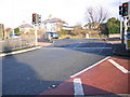
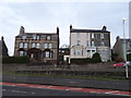
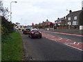
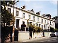
4 photos from this area
Area Information
Key information about the CA28 6TJ including its size, population, and administrative classification.
- Area Type
- Postcode
- Area Size
- 2.6 hectares
- Population
- 1341
- Population Density
- 3210 people/km²
House Prices in CA28 6TJ
53
Properties
£177,241
Average Sold Price
£20,000
Lowest Price
£310,000
Highest Price
Showing 53 properties
| Address | Type | Beds | Baths | Last Sale Price | Last Sale Date | |
|---|---|---|---|---|---|---|
| 32 The Crest, Whitehaven, CA28 6TJ | house | - | - | £181,500 | Mar 2025 | |
| 12 The Crest, Whitehaven, CA28 6TJ | Semi-detached | 4 | 2 | £279,950 | Mar 2025 | |
| 35 The Crest, Whitehaven, CA28 6TJ | house | - | - | £190,000 | Sep 2024 | |
| 28 The Crest, Whitehaven, CA28 6TJ | house | - | - | £250,000 | Aug 2024 | |
| 9 The Crest, Whitehaven, CA28 6TJ | Semi-detached | 3 | 1 | £225,000 | Apr 2024 | |
| 44 The Crest, Whitehaven, CA28 6TJ | Semi-detached | 3 | 2 | £205,000 | Jan 2024 | |
| 16 The Crest, Whitehaven, CA28 6TJ | Semi-detached | 3 | 2 | £230,000 | Oct 2023 | |
| 23 The Crest, Whitehaven, CA28 6TJ | Semi-detached | 3 | 2 | £194,000 | Jun 2023 | |
| 10 The Crest, Whitehaven, CA28 6TJ | Semi-detached | 3 | 1 | £219,950 | Nov 2022 | |
| 19 The Crest, Whitehaven, CA28 6TJ | Semi-detached | 3 | 2 | £220,000 | Sep 2022 |
Page 1 of 6
Energy Efficiency in CA28 6TJ
Amenities
Schools
| Rank | School | Type | Entry gender | Ages |
|---|
Explore more schools in this area
Go to Schools tabDemographics
Household Size
Family (3-5 people)
most common
Accommodation Type
Houses
most common
Tenure
94
majority
Ethnic Group
White
most common
Religion
N/A
most common
Household Composition
N/A
most common
Age
47
median
Adults (30-64 years)
most common
Household Deprivation
N/A
with no deprivation
NS-SEC
38
in Lower managerial occupations
Explore more demographic insights in this area
Go to Demographics tabPlanning
Planning Constraints
- Flood RiskPremium
- Ramsar Wetland SitesPremium
- Area of Outstanding Natural BeautyPremium
- Protected Nature ReservePremium
- Protected WoodlandPremium