Area Overview for CA28 6LW
Photos of CA28 6LW
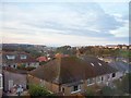
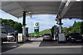
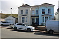
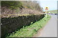
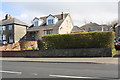
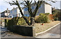
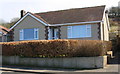
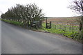

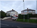
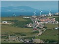
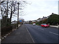
17 photos from this area
Area Information
Key information about the CA28 6LW including its size, population, and administrative classification.
- Area Type
- Postcode
- Area Size
- 7738 m²
- Population
- 1657
- Population Density
- 1048 people/km²
House Prices in CA28 6LW
16
Properties
£144,744
Average Sold Price
£53,000
Lowest Price
£270,000
Highest Price
Showing 16 properties
| Address | Type | Beds | Baths | Last Sale Price | Last Sale Date | |
|---|---|---|---|---|---|---|
| Auden-dene, 37 Loop Road North, Whitehaven, CA28 6LW | Semi-detached | 3 | 1 | £270,000 | Apr 2025 | |
| Croasdale, 49 Loop Road North, Whitehaven, CA28 6LW | Semi-detached | 3 | - | £199,950 | Feb 2019 | |
| 41 Loop Road North, Whitehaven, CA28 6LW | Semi-detached | 3 | 1 | £148,000 | Dec 2018 | |
| 51 Loop Road North, Whitehaven, CA28 6LW | Semi-detached | 3 | - | £145,000 | Apr 2017 | |
| 57 Loop Road North, Whitehaven, CA28 6LW | Semi-detached | 3 | 1 | £130,000 | Aug 2016 | |
| 45 Loop Road North, Whitehaven, CA28 6LW | Semi-detached | 3 | - | £158,000 | Apr 2015 | |
| 43 Loop Road North, Whitehaven, CA28 6LW | Terraced | - | - | £54,000 | Aug 2000 | |
| Briallym, 59 Loop Road North, Whitehaven, CA28 6LW | Semi-detached | - | - | £53,000 | May 1999 | |
| 59A Loop Road North, Whitehaven, CA28 6LW | Detached | 3 | 2 | - | - | |
| 59B Loop Road North, Whitehaven, CA28 6LW | house | 3 | 2 | - | - |
Page 1 of 2
Energy Efficiency in CA28 6LW
Amenities
Schools
| Rank | School | Type | Entry gender | Ages |
|---|
Explore more schools in this area
Go to Schools tabDemographics
Household Size
Two person
most common
Accommodation Type
Houses
most common
Tenure
95
majority
Ethnic Group
White
most common
Religion
N/A
most common
Household Composition
N/A
most common
Age
47
median
Adults (30-64 years)
most common
Household Deprivation
N/A
with no deprivation
NS-SEC
40
in Lower managerial occupations
Explore more demographic insights in this area
Go to Demographics tabPlanning
Planning Constraints
- Flood RiskPremium
- Ramsar Wetland SitesPremium
- Area of Outstanding Natural BeautyPremium
- Protected Nature ReservePremium
- Protected WoodlandPremium