Area Overview for CA27 0BD
Photos of CA27 0BD
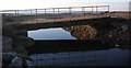
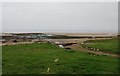
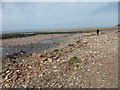
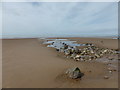
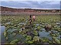
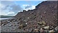
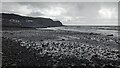
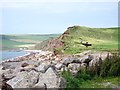
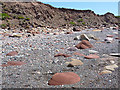
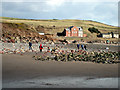
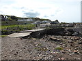

20 photos from this area
Area Information
Key information about the CA27 0BD including its size, population, and administrative classification.
- Area Type
- Postcode
- Area Size
- 79.8 hectares
- Population
- 1638
- Population Density
- 110 people/km²
House Prices in CA27 0BD
45
Properties
£226,230
Average Sold Price
£75,000
Lowest Price
£495,000
Highest Price
Showing 45 properties
| Address | Type | Beds | Baths | Last Sale Price | Last Sale Date | |
|---|---|---|---|---|---|---|
| Colt House, Sea Mill Lane, St Bees, CA27 0BD | Detached | 3 | 2 | £175,000 | Sep 2025 | |
| Hedingham House, Sea Mill Lane, St Bees, CA27 0BD | house | 5 | 2 | £495,000 | Dec 2024 | |
| Strandby House, Sea Mill Lane, St Bees, CA27 0BD | house | 3 | 2 | £470,000 | Sep 2024 | |
| Bankside, Sea Mill Lane, St Bees, CA27 0BD | Semi-detached | 2 | 1 | £270,000 | May 2024 | |
| 2, West View, Sea Mill Lane, St Bees, CA27 0BD | house | 3 | - | £310,000 | Sep 2022 | |
| Lynwood, Sea Mill Lane, St Bees, CA27 0BD | Detached | 3 | 1 | £370,000 | Jul 2022 | |
| Stoneycroft, Sea Mill Lane, St Bees, CA27 0BD | Detached | 3 | 2 | £325,000 | Nov 2021 | |
| Snaefell, Sea Mill Lane, St Bees, CA27 0BD | Bungalow | 4 | 1 | £360,000 | Mar 2021 | |
| Hillside, Sea Mill Lane, St Bees, CA27 0BD | Bungalow | 3 | 1 | £172,000 | Dec 2018 | |
| Sandilands, Sea Mill Lane, St Bees, CA27 0BD | Semi-detached | 4 | 3 | £265,000 | Jan 2017 |
Page 1 of 5
Energy Efficiency in CA27 0BD
Amenities
Schools
| Rank | School | Type | Entry gender | Ages |
|---|
Explore more schools in this area
Go to Schools tabDemographics
Household Size
Two person
most common
Accommodation Type
Houses
most common
Tenure
81
majority
Ethnic Group
White
most common
Religion
N/A
most common
Household Composition
N/A
most common
Age
47
median
Adults (30-64 years)
most common
Household Deprivation
N/A
with no deprivation
NS-SEC
49
in Lower managerial occupations
Explore more demographic insights in this area
Go to Demographics tabPlanning
Planning Constraints
- Flood RiskPremium
- Ramsar Wetland SitesPremium
- Area of Outstanding Natural BeautyPremium
- Protected Nature ReservePremium
- Protected WoodlandPremium