Area Overview for CA20 1AZ
Photos of CA20 1AZ
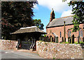
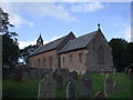
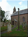
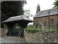
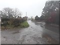
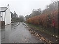
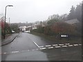
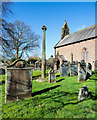
30 photos from this area
Area Information
Key information about the CA20 1AZ including its size, population, and administrative classification.
- Area Type
- Postcode
- Area Size
- 10.5 hectares
- Population
- 1327
- Population Density
- 15 people/km²
House Prices in CA20 1AZ
18
Properties
£341,707
Average Sold Price
£157,000
Lowest Price
£590,000
Highest Price
Showing 18 properties
| Address | Type | Beds | Baths | Last Sale Price | Last Sale Date | |
|---|---|---|---|---|---|---|
| Cuilfail, Gosforth, Gosforth, CA20 1AZ | Semi-detached | 2 | 2 | £280,000 | Jun 2021 | |
| The Beeches, Gosforth, Gosforth, CA20 1AZ | Bungalow | - | - | £450,000 | Dec 2020 | |
| Kirk Stile, Gosforth, Gosforth, CA20 1AZ | Detached | 4 | 2 | £435,000 | Dec 2018 | |
| 2, Spout House, Gosforth, Gosforth, CA20 1AZ | house | - | - | £190,000 | Feb 2018 | |
| 1, Spout House, Gosforth, Gosforth, CA20 1AZ | house | - | - | £157,000 | Aug 2009 | |
| Hallgarth, Gosforth, Gosforth, CA20 1AZ | Detached | - | - | £289,950 | Sep 2006 | |
| Ellerslie, Gosforth, Gosforth, CA20 1AZ | house | - | - | £590,000 | May 2006 | |
| The Barn, Gosforth Hall, Gosforth, Gosforth, CA20 1AZ | house | 4 | 4 | - | - | |
| Aldenstone, Gosforth, Gosforth, CA20 1AZ | Detached | - | - | - | - | |
| Ash Lodge, Gosforth, Gosforth, CA20 1AZ | house | - | - | - | - |
Page 1 of 2
Energy Efficiency in CA20 1AZ
Amenities
Schools
| Rank | School | Type | Entry gender | Ages |
|---|
Explore more schools in this area
Go to Schools tabDemographics
Household Size
Two person
most common
Accommodation Type
Houses
most common
Tenure
81
majority
Ethnic Group
White
most common
Religion
N/A
most common
Household Composition
N/A
most common
Age
47
median
Adults (30-64 years)
most common
Household Deprivation
N/A
with no deprivation
NS-SEC
41
in Lower managerial occupations
Explore more demographic insights in this area
Go to Demographics tabPlanning
Planning Constraints
- Flood RiskPremium
- Ramsar Wetland SitesPremium
- Area of Outstanding Natural BeautyPremium
- Protected Nature ReservePremium
- Protected WoodlandPremium