Area Overview for CA19 1UH
Photos of CA19 1UH
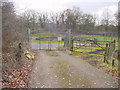
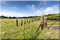
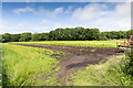
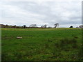
8 photos from this area
Area Information
Key information about the CA19 1UH including its size, population, and administrative classification.
- Area Type
- Postcode
- Area Size
- 48.6 hectares
- Population
- 1112
- Population Density
- 9 people/km²
House Prices in CA19 1UH
18
Properties
£188,288
Average Sold Price
£87,500
Lowest Price
£379,950
Highest Price
Showing 18 properties
| Address | Type | Beds | Baths | Last Sale Price | Last Sale Date | |
|---|---|---|---|---|---|---|
| Bank House, Holmrook, Holmrook, CA19 1UH | Detached | 5 | 1 | £235,000 | Aug 2025 | |
| Hawkrigg, Holmrook, Holmrook, CA19 1UH | Bungalow | 3 | 1 | £126,000 | Dec 2022 | |
| Anglair Drie, Holmrook, Holmrook, CA19 1UH | Detached | 3 | 2 | £325,000 | May 2022 | |
| Alderlea, Holmrook, Holmrook, CA19 1UH | Bungalow | 2 | 1 | £117,000 | Sep 2021 | |
| Riverholme, Holmrook, Holmrook, CA19 1UH | Bungalow | 2 | 2 | £165,000 | Mar 2019 | |
| The Old Orchard, Holmrook, Holmrook, CA19 1UH | Bungalow | 3 | - | £379,950 | Aug 2018 | |
| Fell View, Holmrook, Holmrook, CA19 1UH | Bungalow | 2 | - | £125,000 | Mar 2016 | |
| Sunnyside, Holmrook, Holmrook, CA19 1UH | house | - | - | £115,000 | Oct 2010 | |
| Irtside, Holmrook, Holmrook, CA19 1UH | Detached | 6 | 3 | £335,000 | Mar 2004 | |
| Ravenscraig, Holmrook, Holmrook, CA19 1UH | Bungalow | - | - | £87,500 | Mar 1999 |
Page 1 of 2
Energy Efficiency in CA19 1UH
Amenities
Schools
| Rank | School | Type | Entry gender | Ages |
|---|
Explore more schools in this area
Go to Schools tabDemographics
Household Size
Two person
most common
Accommodation Type
Houses
most common
Tenure
82
majority
Ethnic Group
White
most common
Religion
N/A
most common
Household Composition
N/A
most common
Age
47
median
Adults (30-64 years)
most common
Household Deprivation
N/A
with no deprivation
NS-SEC
39
in Lower managerial occupations
Explore more demographic insights in this area
Go to Demographics tabPlanning
Planning Constraints
- Flood RiskPremium
- Ramsar Wetland SitesPremium
- Area of Outstanding Natural BeautyPremium
- Protected Nature ReservePremium
- Protected WoodlandPremium