Area Overview for CA17 4DX
Photos of CA17 4DX
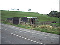
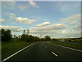
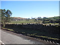
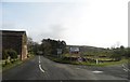
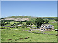
27 photos from this area
Area Information
Key information about the CA17 4DX including its size, population, and administrative classification.
- Area Type
- Postcode
- Area Size
- 1.9 km²
- Population
- 2356
- Population Density
- 11 people/km²
House Prices in CA17 4DX
10
Properties
£186,667
Average Sold Price
£186,667
Lowest Price
£186,667
Highest Price
Showing 10 properties
| Address | Type | Beds | Baths | Last Sale Price | Last Sale Date | |
|---|---|---|---|---|---|---|
| Pleasant View, Brough On The U 3572 From The B 6276 To The A 66, Brough, CA17 4DX | Bungalow | 3 | 1 | £186,667 | Apr 2012 | |
| Mount Pleasant Farm, Brough On The U 3572 From The B 6276 To The A 66, Brough, CA17 4DX | Semi-detached | - | - | - | - | |
| Lane Head Farm, Brough On The U 3572 From The B 6276 To The A 66, Brough, CA17 4DX | Detached | 3 | - | - | - | |
| Augill House, Access To Augill Bridge, Brough, CA17 4DX | Detached | - | - | - | - | |
| Ghyll Brow, Access To Augill Bridge, Brough, CA17 4DX | Detached | - | - | - | - | |
| Wardens Lodge, Augill Caravan Park, Access To Augill Bridge, Brough, CA17 4DX | Detached | - | - | - | - | |
| Riggs Cottage, Brough On The U 3572 From The B 6276 To The A 66, Brough, CA17 4DX | house | - | - | - | - | |
| Forest Farm, Brough Bypass On The A 66 T, Brough, CA17 4DX | Detached | - | - | - | - | |
| Augill Lodge, Access To Augill Bridge, Brough, CA17 4DX | Detached | - | - | - | - | |
| Verteris House, Access To Augill Bridge, Brough, CA17 4DX | house | - | - | - | - |
Energy Efficiency in CA17 4DX
Amenities
Schools
| Rank | School | Type | Entry gender | Ages |
|---|
Explore more schools in this area
Go to Schools tabDemographics
Household Size
Two person
most common
Accommodation Type
Houses
most common
Tenure
76
majority
Ethnic Group
White
most common
Religion
N/A
most common
Household Composition
N/A
most common
Age
47
median
Adults (30-64 years)
most common
Household Deprivation
N/A
with no deprivation
NS-SEC
29
in Lower managerial occupations
Explore more demographic insights in this area
Go to Demographics tabPlanning
Planning Constraints
- Flood RiskPremium
- Ramsar Wetland SitesPremium
- Area of Outstanding Natural BeautyPremium
- Protected Nature ReservePremium
- Protected WoodlandPremium