Area Overview for CA17 4DS
Photos of CA17 4DS
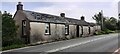
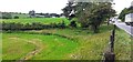
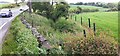
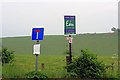
17 photos from this area
Area Information
Key information about the CA17 4DS including its size, population, and administrative classification.
- Area Type
- Postcode
- Area Size
- 4.1 km²
- Population
- 2356
- Population Density
- 11 people/km²
House Prices in CA17 4DS
12
Properties
£344,000
Average Sold Price
£141,000
Lowest Price
£600,000
Highest Price
Showing 12 properties
| Address | Type | Beds | Baths | Last Sale Price | Last Sale Date | |
|---|---|---|---|---|---|---|
| Cherry Tree House, Brough From The A 66 To Main Street, Brough, CA17 4DS | Detached | 3 | 2 | £425,000 | May 2025 | |
| Croft Cottage, Access Road To West View, Brough, CA17 4DS | Detached | - | - | £210,000 | Aug 2023 | |
| Mains House, Access Road To West View, Brough, CA17 4DS | house | 3 | - | £600,000 | Jul 2023 | |
| Old Long Byre, Road From Brough Hill To Bullistone Bridge On The A 66 T, Brough, CA17 4DS | Detached | - | - | £141,000 | May 2000 | |
| West View Farm, Access Road To West View, Brough, CA17 4DS | Detached | 5 | 1 | - | - | |
| Rowan House, Musgrave Lane, Brough, CA17 4DS | Detached | 4 | 2 | - | - | |
| Fox Tower Stables, Access Road To West View, Brough, CA17 4DS | Mobile Home | - | - | - | - | |
| The Warren, Main Street, Brough, CA17 4DS | Detached | - | - | - | - | |
| Thompsons Garage, Unit 1A, Brough Industrial Estate, Main Street, Brough, CA17 4DS | Industrial | - | - | - | - | |
| Toll Bar Cottage, Road From Brough Hill To Bullistone Bridge On The A 66 T, Brough, CA17 4DS | Detached | - | - | - | - |
Page 1 of 2
Energy Efficiency in CA17 4DS
Amenities
Schools
| Rank | School | Type | Entry gender | Ages |
|---|
Explore more schools in this area
Go to Schools tabDemographics
Household Size
Two person
most common
Accommodation Type
Houses
most common
Tenure
76
majority
Ethnic Group
White
most common
Religion
N/A
most common
Household Composition
N/A
most common
Age
47
median
Adults (30-64 years)
most common
Household Deprivation
N/A
with no deprivation
NS-SEC
29
in Lower managerial occupations
Explore more demographic insights in this area
Go to Demographics tabPlanning
Planning Constraints
- Flood RiskPremium
- Ramsar Wetland SitesPremium
- Area of Outstanding Natural BeautyPremium
- Protected Nature ReservePremium
- Protected WoodlandPremium