Area Overview for CA16 6SB
Photos of CA16 6SB
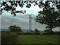
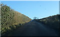

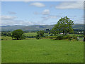
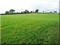
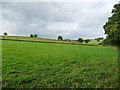
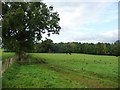
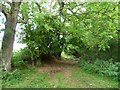
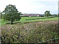
18 photos from this area
Area Information
Key information about the CA16 6SB including its size, population, and administrative classification.
- Area Type
- Postcode
- Area Size
- 16.3 hectares
- Population
- 1230
- Population Density
- 304 people/km²
House Prices in CA16 6SB
72
Properties
£153,124
Average Sold Price
£36,000
Lowest Price
£249,000
Highest Price
Showing 72 properties
| Address | Type | Beds | Baths | Last Sale Price | Last Sale Date | |
|---|---|---|---|---|---|---|
| 40 Barrowmoor Road, Appleby In Westmorland, CA16 6SB | Detached | 3 | 1 | £249,000 | Oct 2025 | |
| 18 Barrowmoor Road, Appleby In Westmorland, CA16 6SB | house | 3 | 1 | £224,200 | Aug 2025 | |
| 31 Barrowmoor Road, Appleby In Westmorland, CA16 6SB | house | - | - | £218,000 | Sep 2024 | |
| 56 Barrowmoor Road, Appleby In Westmorland, CA16 6SB | Bungalow | - | - | £195,000 | Feb 2023 | |
| 5 Barrowmoor Road, Appleby In Westmorland, CA16 6SB | Terraced | 3 | 1 | £215,000 | Jun 2022 | |
| 38 Barrowmoor Road, Appleby In Westmorland, CA16 6SB | Retail | 2 | - | £151,000 | Jun 2022 | |
| 78 Barrowmoor Road, Appleby In Westmorland, CA16 6SB | Bungalow | - | - | £195,000 | Jan 2022 | |
| 33 Barrowmoor Road, Appleby In Westmorland, CA16 6SB | house | - | - | £174,000 | Aug 2021 | |
| 6 Barrowmoor Road, Appleby In Westmorland, CA16 6SB | Semi-detached | 3 | 1 | £180,750 | Jul 2021 | |
| 70 Barrowmoor Road, Appleby In Westmorland, CA16 6SB | Bungalow | - | - | £172,500 | Jun 2021 |
Page 1 of 8
Energy Efficiency in CA16 6SB
Amenities
Schools
| Rank | School | Type | Entry gender | Ages |
|---|
Explore more schools in this area
Go to Schools tabDemographics
Household Size
One person
most common
Accommodation Type
Houses
most common
Tenure
60
majority
Ethnic Group
White
most common
Religion
N/A
most common
Household Composition
N/A
most common
Age
47
median
Adults (30-64 years)
most common
Household Deprivation
N/A
with no deprivation
NS-SEC
23
in Lower managerial occupations
Explore more demographic insights in this area
Go to Demographics tabPlanning
Planning Constraints
- Flood RiskPremium
- Ramsar Wetland SitesPremium
- Area of Outstanding Natural BeautyPremium
- Protected Nature ReservePremium
- Protected WoodlandPremium