Area Overview for CA15 9AE
Photos of CA15 9AE


Area Information
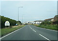
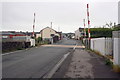
Living in CA15 9AE means being part of a small, tightly knit residential cluster in Allerdale, Cumbria. The area’s population of 1,555 is spread across a compact footprint, with a density of 854 people per square kilometre. This postcode lies within the historic town of Maryport, a coastal settlement with roots in Roman times and 18th-century industrial development. Today, it retains a quiet, community-focused character, with a median age of 47 and a population skewed toward adults aged 30–64. The area is predominantly owner-occupied, with 53% of homes owned by residents, and most properties are houses rather than flats. Proximity to the River Ellen and the Solway Firth shapes daily life, offering scenic views and a connection to the region’s industrial heritage. While the area is small, it benefits from nearby rail links and local amenities, making it a practical choice for those seeking a balance between coastal charm and practicality.
- Area Type
- Postcode
- Area Size
- Not available
- Population
- 1555
- Population Density
- 854 people/km²
The property market in CA15 9AE is characterised by a predominance of owner-occupied homes, with 53% of properties owned by residents. The area is largely composed of houses, which contrasts with regions where flats or apartments dominate. This suggests a housing stock tailored to families or individuals seeking more space, though the small size of the postcode means the overall market is limited. Buyers should consider the proximity to nearby towns like Workington and Maryport, where additional property options may be available. The low population density and compact footprint of CA15 9AE mean that properties here are likely to be part of a broader network of homes in surrounding areas. For those prioritising a quiet, residential environment, the area offers a mix of traditional housing and coastal location, though the small size may limit choices for buyers seeking specific property types.
House Prices in CA15 9AE
No properties found in this postcode.
Energy Efficiency in CA15 9AE
The lifestyle in CA15 9AE is shaped by its proximity to local shops and transport links. Within practical reach are five retail outlets, including Lidl Maryport, Spar, and Heron Maryport, offering everyday essentials and convenience for residents. The area’s rail stations—Maryport, Flimby, and Workington—provide access to broader networks, enabling travel to nearby towns for leisure, shopping, or work. While the data does not mention parks or leisure facilities directly, the coastal location of Maryport suggests opportunities for outdoor activities along the River Ellen and Solway Firth. The small scale of the area means that daily life revolves around local amenities and community hubs, with a focus on practicality and accessibility. The mix of retail and transport options supports a self-contained lifestyle, though residents may need to venture further for more extensive leisure or cultural offerings.
Amenities
Schools
The nearest school to CA15 9AE is Grasslot Infant School, a primary school with an Ofsted rating of ‘good’. This indicates a solid foundation for early education, though families requiring secondary schooling will need to look beyond the immediate area. The presence of a primary school with a positive rating is a key consideration for parents, offering a local option for younger children. However, the absence of listed secondary schools means that residents may need to travel to nearby towns like Workington or Maryport for further education. The school’s rating reflects the quality of teaching and facilities, but prospective buyers should verify whether the school’s capacity aligns with local demand, particularly given the area’s population size and age profile.
| Rank | School | Type | Entry gender | Ages |
|---|
Explore more schools in this area
Go to Schools tabDemographics
The community in CA15 9AE is defined by its age profile, with a median age of 47 and the majority of residents falling into the 30–64 age range. This suggests a population of working-age adults and older families, with fewer younger or retired residents. Home ownership stands at 53%, slightly below the UK average, but the area is primarily composed of houses rather than flats, reflecting a more traditional housing stock. The predominant ethnic group is White, with no specific data on diversity or deprivation levels provided. The age demographic indicates a stable, established community, though the lack of younger residents may impact local schools and amenities. The relatively high proportion of adults suggests a focus on family homes and long-term residency, with limited evidence of transient populations.
Household Size
Accommodation Type
Tenure
Ethnic Group
Religion
Household Composition
Age
Household Deprivation
NS-SEC
Explore more demographic insights in this area
Go to Demographics tabPlanning
Planning Constraints
- Flood RiskPremium
- Ramsar Wetland SitesPremium
- Area of Outstanding Natural BeautyPremium
- Protected Nature ReservePremium
- Protected WoodlandPremium