Area Overview for CA15 9AA
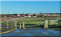
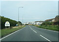
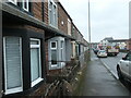
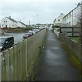
Photos of CA15 9AA


Area Information
Living in CA15 9AA, a small residential cluster in Cumbria, offers a quiet, compact lifestyle with a distinct historical character. The area’s population of 1,555 people is spread across 854 residents per square kilometre, reflecting a tight-knit community. Situated in Maryport, a coastal town with Roman origins, the area blends historical significance with modern living. The town was planned in the 18th century to support coal and shipping industries, leaving a legacy of grid-patterned streets and industrial heritage. Today, CA15 9AA’s residents benefit from proximity to the River Ellen and the Solway Firth, though the area is more suburban than coastal. Daily life here is shaped by its small size and limited amenities, with a focus on local shops, rail links, and nearby towns. The demographic profile suggests a mature population, with a median age of 47, and a strong presence of adults aged 30–64. This makes CA15 9AA a place of stability, where families and long-term residents coexist in a setting that prioritises practicality over urban vibrancy.
- Area Type
- Postcode
- Area Size
- Not available
- Population
- 1555
- Population Density
- 854 people/km²
The property market in CA15 9AA is defined by a 53% home ownership rate, suggesting that nearly half of properties are owner-occupied, while the remaining 47% are likely rental units. The accommodation type is predominantly houses, which contrasts with areas where flats or apartments dominate. This indicates a housing stock suited to families or individuals prioritising space and privacy over high-density living. Given the area’s small size and limited expansion potential, the market is likely constrained, with few new developments. Buyers should consider that the majority of homes are owner-occupied, which may affect availability and competition. The focus on houses also means that properties are likely to be larger than average, though the exact sizes or price ranges are not specified. For those seeking a quiet, suburban setting, CA15 9AA offers a stable but niche market, with limited options for those preferring urban or high-rise living.
House Prices in CA15 9AA
No properties found in this postcode.
Energy Efficiency in CA15 9AA
The lifestyle in CA15 9AA is shaped by its proximity to five retail venues, including Lidl Maryport, Spar, and Heron Maryport, offering everyday shopping and convenience. These stores cater to basic needs, though the absence of larger supermarkets or specialty shops means residents may need to travel further for more extensive retail options. The area’s rail links to Maryport, Flimby, and Workington provide access to broader amenities, including leisure facilities, dining, and cultural attractions in nearby towns. While the data does not specify parks or recreational areas within CA15 9AA itself, the surrounding region’s historical and natural features—such as the River Ellen—may offer outdoor opportunities. The combination of local shops and rail connectivity creates a practical but limited lifestyle, where daily needs are met locally, but more diverse experiences require travel. This suits those prioritising simplicity and a quiet environment over urban convenience.
Amenities
Schools
The only school explicitly listed near CA15 9AA is Grasslot Infant School, a primary institution with a good Ofsted rating. This means the area has access to a reputable early education option for younger children, though no secondary schools or further education facilities are mentioned in the data. The presence of a single primary school suggests that families with children may need to travel to nearby towns for secondary education, as the area’s small size limits the number of schools available. The good Ofsted rating indicates that Grasslot Infant School meets or exceeds standards in teaching quality and student outcomes, which is a positive for parents prioritising educational quality. However, the absence of other schools means the area is not ideal for families requiring a full range of educational options without commuting.
| Rank | School | Type | Entry gender | Ages |
|---|
Explore more schools in this area
Go to Schools tabDemographics
The community in CA15 9AA is predominantly composed of adults aged 30–64, with a median age of 47. This suggests a population skewed towards middle-aged individuals, likely including retirees and those in their prime working years. Home ownership stands at 53%, indicating a mix of owner-occupied properties and rental units, though the exact proportion of renters is not specified. The area is characterised by houses rather than flats or apartments, which aligns with the demographic of families and individuals seeking more space. The predominant ethnic group is White, reflecting the broader trends in rural Cumbria. While no specific data on deprivation or income levels is provided, the high home ownership rate and stable age profile imply a community with established roots and a moderate quality of life. The absence of detailed diversity metrics means the area’s social composition remains largely homogeneous, with no indication of significant cultural or ethnic variation.
Household Size
Accommodation Type
Tenure
Ethnic Group
Religion
Household Composition
Age
Household Deprivation
NS-SEC
Explore more demographic insights in this area
Go to Demographics tabPlanning
Planning Constraints
- Flood RiskPremium
- Ramsar Wetland SitesPremium
- Area of Outstanding Natural BeautyPremium
- Protected Nature ReservePremium
- Protected WoodlandPremium