Area Overview for CA15 7DN
Photos of CA15 7DN
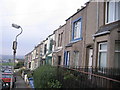
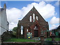
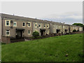
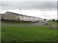
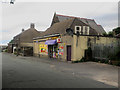
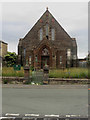
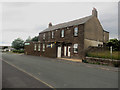
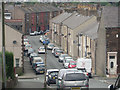

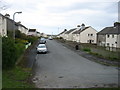
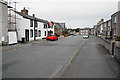
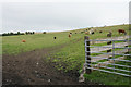
36 photos from this area
Area Information
Key information about the CA15 7DN including its size, population, and administrative classification.
- Area Type
- Postcode
- Area Size
- 2.8 hectares
- Population
- 1385
- Population Density
- 1635 people/km²
House Prices in CA15 7DN
35
Properties
£59,354
Average Sold Price
£39,000
Lowest Price
£92,000
Highest Price
Showing 35 properties
| Address | Type | Beds | Baths | Last Sale Price | Last Sale Date | |
|---|---|---|---|---|---|---|
| 30 Main Street, Ellenborough, CA15 7DN | Terraced | 2 | 1 | £65,000 | May 2023 | |
| 8 Main Street, Ellenborough, CA15 7DN | house | - | - | £70,000 | Nov 2021 | |
| Almlea, Main Street, Ellenborough, CA15 7DN | Bungalow | - | - | £92,000 | Mar 2021 | |
| 14 Main Street, Ellenborough, CA15 7DN | Terraced | 1 | 1 | £45,000 | Mar 2021 | |
| 22 Main Street, Ellenborough, CA15 7DN | Terraced | 3 | - | £85,000 | Jul 2015 | |
| 1, Lowcroft, Main Street, Ellenborough, CA15 7DN | Bungalow | 5 | 2 | £50,000 | Nov 2014 | |
| 24 Main Street, Ellenborough, CA15 7DN | house | - | - | £69,000 | Jul 2013 | |
| 9 Main Street, Ellenborough, CA15 7DN | house | - | - | £66,000 | Jun 2011 | |
| 20 Main Street, Ellenborough, CA15 7DN | house | - | - | £39,000 | Nov 2009 | |
| Moorside Bungalow, Main Street, Ellenborough, CA15 7DN | Bungalow | - | - | £49,000 | Jun 2005 |
Page 1 of 4
Energy Efficiency in CA15 7DN
Amenities
Schools
| Rank | School | Type | Entry gender | Ages |
|---|
Explore more schools in this area
Go to Schools tabDemographics
Household Size
One person
most common
Accommodation Type
Houses
most common
Tenure
40
majority
Ethnic Group
White
most common
Religion
N/A
most common
Household Composition
N/A
most common
Age
47
median
Adults (30-64 years)
most common
Household Deprivation
N/A
with no deprivation
NS-SEC
14
in Lower managerial occupations
Explore more demographic insights in this area
Go to Demographics tabPlanning
Planning Constraints
- Flood RiskPremium
- Ramsar Wetland SitesPremium
- Area of Outstanding Natural BeautyPremium
- Protected Nature ReservePremium
- Protected WoodlandPremium