Area Overview for CA14 5DS
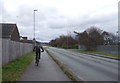
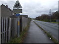
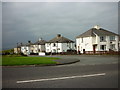
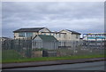
Photos of CA14 5DS

Area Information
CA14 5DS is a small residential postcode area in England, nestled within the historic market town of Workington in Cumbria. Covering just 2.9 hectares, it is a compact cluster of homes serving a population of 1,684 residents. With a population density of 58,039 people per square kilometre, the area is densely populated for its size, reflecting the town’s long-standing role as a regional hub. Workington itself sits at the mouth of the River Derwent, a location that has shaped its development from medieval times through industrial expansion. Today, the area balances its historical roots with modern living, offering proximity to coastal landscapes and a network of local amenities. Residents benefit from a mix of retail, transport, and community services within easy reach, while the town’s heritage—marked by Roman forts, 19th-century ironworks, and grid-planned streets—adds a distinct character. For those seeking a blend of compact living and access to a historic town, CA14 5DS offers a focused, tightly knit environment.
- Area Type
- Postcode
- Area Size
- 2.9 hectares
- Population
- 1684
- Population Density
- 58039 people/km²
The property market in CA14 5DS is characterised by a 43% home ownership rate, which is below the national average, indicating a stronger presence of rental properties in the area. The accommodation type is predominantly houses, which are more common than flats or apartments. This suggests a housing stock that leans toward traditional, standalone homes, likely appealing to those prioritising space and privacy. Given the area’s small size and high population density, the market is likely competitive, with limited new developments. Buyers should consider the proximity to local amenities and transport links, as well as the town’s historical and industrial heritage. The rental market may offer opportunities for investors, though the lower home ownership rate could signal a preference for renting among residents.
House Prices in CA14 5DS
Showing 1 properties
| Address | Type | Beds | Baths | Last Sale Price | Last Sale Date | |
|---|---|---|---|---|---|---|
| Mcmenon Engineering, Salterbeck Trading Estate, Salterbeck, CA14 5DS | office_workshop | - | - | - | - |
Energy Efficiency in CA14 5DS
The lifestyle in CA14 5DS is shaped by its proximity to a range of local amenities. Within practical reach are five retail outlets, including Asda Workington Moss, Spar, and Morrisons Daily, offering everyday shopping needs. The area’s rail network, with stations such as Harrington and Workington, provides easy access to commuting and regional travel. While the postcode itself is small, the town of Workington offers additional leisure and cultural options, including historical sites like the Roman Catholic church of Our Lady Star of the Sea and the Derwent Paper Mills. The compact nature of the area means that daily life is centred around local shops, community hubs, and the surrounding town. For residents, the balance of convenience and historical character creates a lifestyle that is both practical and rooted in tradition.
Amenities
Schools
The nearest school to CA14 5DS is St Mary’s Catholic Primary School, which holds a ‘good’ Ofsted rating. This primary school serves the local community, offering education for younger children in a faith-based setting. The absence of secondary schools in the immediate vicinity means families may need to look further afield for secondary education, though the town of Workington itself is likely within practical reach. The presence of a single primary school with a strong rating suggests that the area is well-served for early education, but parents seeking a broader range of school options may need to consider commuting. The school’s ‘good’ rating indicates a satisfactory standard of teaching and facilities, though no additional details about its curriculum or student outcomes are available.
| Rank | School | Type | Entry gender | Ages |
|---|
Explore more schools in this area
Go to Schools tabDemographics
The community in CA14 5DS is predominantly composed of adults aged 30–64, with a median age of 47. This suggests a mature population, likely with established careers and families. Home ownership sits at 43%, indicating a mix of owner-occupied and rental properties, though the lower figure points to a rental market that may cater to younger professionals or those seeking flexibility. The accommodation type is primarily houses, reflecting a preference for standalone properties over flats. The predominant ethnic group is White, with no specific data on diversity or deprivation levels provided. This demographic profile implies a stable, middle-aged population with a focus on long-term residency. The age range and home ownership rate suggest a community that is neither heavily skewed toward retirees nor young families, but rather a balance of both.
Household Size
Accommodation Type
Tenure
Ethnic Group
Religion
Household Composition
Age
Household Deprivation
NS-SEC
Explore more demographic insights in this area
Go to Demographics tabPlanning
Planning Constraints
- Flood RiskPremium
- Ramsar Wetland SitesPremium
- Area of Outstanding Natural BeautyPremium
- Protected Nature ReservePremium
- Protected WoodlandPremium