Area Overview for CA14 3RL
Photos of CA14 3RL
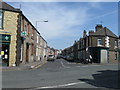
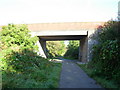
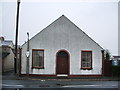
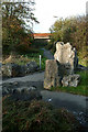
9 photos from this area
Area Information
Key information about the CA14 3RL including its size, population, and administrative classification.
- Area Type
- Postcode
- Area Size
- 7619 m²
- Population
- 1533
- Population Density
- 2216 people/km²
House Prices in CA14 3RL
10
Properties
£89,500
Average Sold Price
£85,000
Lowest Price
£94,000
Highest Price
Showing 10 properties
| Address | Type | Beds | Baths | Last Sale Price | Last Sale Date | |
|---|---|---|---|---|---|---|
| 122 Westfield Drive, Workington, CA14 3RL | house | - | - | £85,000 | Sep 2021 | |
| 126 Westfield Drive, Workington, CA14 3RL | Semi-detached | 3 | 1 | £94,000 | May 2006 | |
| 124 Westfield Drive, Workington, CA14 3RL | Semi-detached | 3 | 1 | - | - | |
| Unit 6 Waiting Room Top Yard, Moorclose Depot, Westfield Drive, Workington, CA14 3RL | Office | - | - | - | - | |
| 118 Westfield Drive, Workington, CA14 3RL | house | - | - | - | - | |
| 110 Westfield Drive, Workington, CA14 3RL | house | - | - | - | - | |
| 116 Westfield Drive, Workington, CA14 3RL | house | - | - | - | - | |
| 112 Westfield Drive, Workington, CA14 3RL | Semi-detached | - | - | - | - | |
| 114 Westfield Drive, Workington, CA14 3RL | Bungalow | - | - | - | - | |
| 120 Westfield Drive, Workington, CA14 3RL | house | - | - | - | - |
Energy Efficiency in CA14 3RL
Amenities
Schools
| Rank | School | Type | Entry gender | Ages |
|---|
Explore more schools in this area
Go to Schools tabDemographics
Household Size
Two person
most common
Accommodation Type
Houses
most common
Tenure
40
majority
Ethnic Group
White
most common
Religion
N/A
most common
Household Composition
N/A
most common
Age
47
median
Adults (30-64 years)
most common
Household Deprivation
N/A
with no deprivation
NS-SEC
15
in Lower managerial occupations
Explore more demographic insights in this area
Go to Demographics tabPlanning
Planning Constraints
- Flood RiskPremium
- Ramsar Wetland SitesPremium
- Area of Outstanding Natural BeautyPremium
- Protected Nature ReservePremium
- Protected WoodlandPremium