Area Overview for CA13 9FJ
Photos of CA13 9FJ
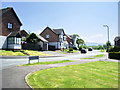
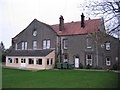
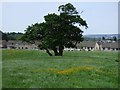
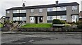
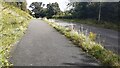
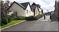
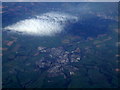
7 photos from this area
Area Information
Key information about the CA13 9FJ including its size, population, and administrative classification.
- Area Type
- Postcode
- Area Size
- 1.7 hectares
- Population
- 1918
- Population Density
- 647 people/km²
House Prices in CA13 9FJ
59
Properties
£300,935
Average Sold Price
£122,200
Lowest Price
£485,000
Highest Price
Showing 59 properties
| Address | Type | Beds | Baths | Last Sale Price | Last Sale Date | |
|---|---|---|---|---|---|---|
| 57 Horseshoe Drive, Cockermouth, CA13 9FJ | Detached | 4 | 4 | £485,000 | Sep 2025 | |
| 34 Horseshoe Drive, Cockermouth, CA13 9FJ | house | - | - | £177,000 | Jan 2025 | |
| 30 Horseshoe Drive, Cockermouth, CA13 9FJ | house | - | - | £175,000 | Dec 2024 | |
| 3 Horseshoe Drive, Cockermouth, CA13 9FJ | Detached | 4 | 2 | £415,000 | Aug 2024 | |
| 20 Horseshoe Drive, Cockermouth, CA13 9FJ | house | - | - | £240,000 | Mar 2023 | |
| 63 Horseshoe Drive, Cockermouth, CA13 9FJ | Detached | 4 | 3 | £354,950 | Aug 2022 | |
| 65 Horseshoe Drive, Cockermouth, CA13 9FJ | house | 4 | 2 | £374,950 | Jul 2022 | |
| 61 Horseshoe Drive, Cockermouth, CA13 9FJ | house | - | - | £369,950 | Jul 2022 | |
| 59 Horseshoe Drive, Cockermouth, CA13 9FJ | house | - | - | £364,950 | Jun 2022 | |
| 7 Horseshoe Drive, Cockermouth, CA13 9FJ | house | - | - | £450,000 | May 2022 |
Page 1 of 6
Energy Efficiency in CA13 9FJ
Amenities
Schools
| Rank | School | Type | Entry gender | Ages |
|---|
Explore more schools in this area
Go to Schools tabDemographics
Household Size
Two person
most common
Accommodation Type
Houses
most common
Tenure
58
majority
Ethnic Group
White
most common
Religion
N/A
most common
Household Composition
N/A
most common
Age
47
median
Adults (30-64 years)
most common
Household Deprivation
N/A
with no deprivation
NS-SEC
30
in Lower managerial occupations
Explore more demographic insights in this area
Go to Demographics tabPlanning
Planning Constraints
- Flood RiskPremium
- Ramsar Wetland SitesPremium
- Area of Outstanding Natural BeautyPremium
- Protected Nature ReservePremium
- Protected WoodlandPremium