Area Overview for CA12 4PD
Photos of CA12 4PD
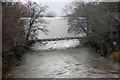
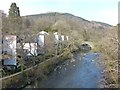
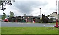
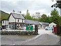
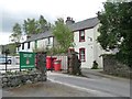
100 photos from this area
Area Information
Key information about the CA12 4PD including its size, population, and administrative classification.
- Area Type
- Postcode
- Area Size
- 7729 m²
- Population
- 2111
- Population Density
- 3037 people/km²
House Prices in CA12 4PD
22
Properties
£211,389
Average Sold Price
£140,000
Lowest Price
£295,000
Highest Price
Showing 22 properties
| Address | Type | Beds | Baths | Last Sale Price | Last Sale Date | |
|---|---|---|---|---|---|---|
| 43 Millfield Gardens, Keswick, CA12 4PD | house | - | - | £275,000 | May 2025 | |
| 39 Millfield Gardens, Keswick, CA12 4PD | Terraced | 3 | 1 | £295,000 | Feb 2025 | |
| 42 Millfield Gardens, Keswick, CA12 4PD | house | - | - | £235,000 | Nov 2020 | |
| 49 Millfield Gardens, Keswick, CA12 4PD | Terraced | 3 | - | £200,000 | Sep 2017 | |
| 52 Millfield Gardens, Keswick, CA12 4PD | Terraced | - | - | £195,000 | Aug 2013 | |
| 41 Millfield Gardens, Keswick, CA12 4PD | house | - | - | £205,000 | Apr 2013 | |
| 48 Millfield Gardens, Keswick, CA12 4PD | house | 3 | - | £190,000 | Jul 2012 | |
| 44 Millfield Gardens, Keswick, CA12 4PD | Terraced | - | - | £167,500 | Dec 2006 | |
| 36 Millfield Gardens, Keswick, CA12 4PD | Terraced | - | - | £140,000 | Jul 2004 | |
| 37 Millfield Gardens, Keswick, CA12 4PD | Terraced | - | - | - | - |
Page 1 of 3
Energy Efficiency in CA12 4PD
Amenities
Schools
| Rank | School | Type | Entry gender | Ages |
|---|
Explore more schools in this area
Go to Schools tabDemographics
Household Size
Two person
most common
Accommodation Type
Houses
most common
Tenure
65
majority
Ethnic Group
White
most common
Religion
N/A
most common
Household Composition
N/A
most common
Age
47
median
Adults (30-64 years)
most common
Household Deprivation
N/A
with no deprivation
NS-SEC
27
in Lower managerial occupations
Explore more demographic insights in this area
Go to Demographics tabPlanning
Planning Constraints
- Flood RiskPremium
- Ramsar Wetland SitesPremium
- Area of Outstanding Natural BeautyPremium
- Protected Nature ReservePremium
- Protected WoodlandPremium