Area Overview for CA12 4GH
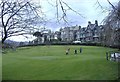
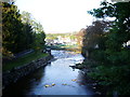
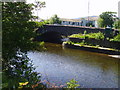
Photos of CA12 4GH

Area Information
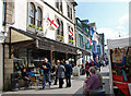
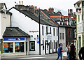
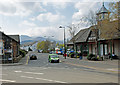
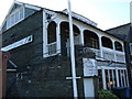
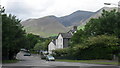
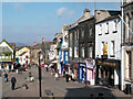
CA12 4GH is a small, tightly knit residential cluster nestled in the Lake District, Cumbria, within the historic market town of Keswick. With a population of 2,111, the area retains a quiet, village-like character despite its proximity to the region’s natural and cultural attractions. Keswick itself is a focal point for the surrounding landscape of fells, lakes, and valleys, offering residents a blend of rural tranquillity and accessible amenities. The town’s origins as a medieval agricultural settlement are reflected in its preserved market square and historic buildings, while its later transformation into a tourist hub has brought a steady flow of visitors. Living here means being close to Derwentwater, a major lake in the Lake District, and the town’s long-standing market, which has operated continuously since 1276. The area’s compact size and low population density create a sense of community, with homes predominantly located in the town’s core, surrounded by open countryside. For those seeking a balance between natural beauty and practical living, CA12 4GH offers a unique blend of historical charm and modern convenience.
- Area Type
- Postcode
- Area Size
- Not available
- Population
- 2111
- Population Density
- 3037 people/km²
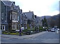
The property market in CA12 4GH is dominated by owner-occupied homes, with 65% of properties owned by residents rather than rented. This high home ownership rate indicates a stable, long-term resident base, typical of smaller towns with limited rental demand. The predominant accommodation type is houses, which aligns with the area’s rural character and the availability of larger properties in the town’s core. Given the postcode’s small size and the concentration of housing within Keswick, the market is likely limited in scale, with few new developments. For buyers, this means a focus on existing homes, often with garden space and proximity to the town’s amenities. The lack of flats or apartments suggests a preference for traditional housing styles, which may appeal to families or those seeking space. However, the small area and limited housing stock could make competition for properties fierce, particularly for homes near key attractions like Derwentwater or the market square.
House Prices in CA12 4GH
No properties found in this postcode.
Energy Efficiency in CA12 4GH
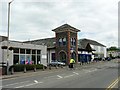
Living in CA12 4GH offers access to a range of amenities within practical reach. The area is served by four retail outlets, including Co-op Keswick, Booths Keswick, and Spar, providing essential shopping and convenience services. Nearby ferry landings such as Keswick Ferry Landing and Nichol End Ferry Landing connect residents to Derwentwater, enabling water-based recreation and access to the Lake District’s scenic routes. The presence of these amenities supports a lifestyle that balances local convenience with the opportunity to explore the surrounding natural landscape. The town’s historical character, combined with its practical retail and transport links, creates a setting where daily life is infused with both rural simplicity and the vibrancy of a tourist-focused market town.
Amenities
Schools
The schools near CA12 4GH include Trinity CofE School and St Herbert’s CofE (VA) Primary and Nursery School, both of which are primary schools with the latter holding a ‘good’ Ofsted rating. St Kentigern’s CofE Infant and Nursery School and Brigham CofE First School also serve the area, though the latter’s category is listed as ‘other’. This mix of primary schools provides families with multiple options for early education, with at least one school recognised for its quality. The presence of nursery provision suggests support for younger children, while the variety of school types may indicate a range of educational philosophies or community needs. For parents, the availability of multiple schools within practical reach reduces the need for long commutes, though the absence of secondary schools in the data means families may need to look further afield for older children’s education.
| Rank | School | Type | Entry gender | Ages |
|---|
Explore more schools in this area
Go to Schools tabDemographics
The population of CA12 4GH is 2,111, with a median age of 47, indicating a community skewed toward middle-aged adults. The most common age range is 30–64 years, suggesting a stable demographic with a focus on working-age households. Home ownership is high at 65%, with the predominant accommodation type being houses rather than flats or apartments. This reflects a residential area where larger properties are more common, likely catering to families or individuals seeking space. The predominant ethnic group is White, with no specific data on other demographics provided. The absence of detailed diversity statistics means the community’s composition remains largely defined by this group. The age profile and home ownership figures suggest a relatively mature population with long-term residency, though the lack of data on deprivation or income levels means it is unclear how economic factors influence quality of life. The area’s small size and focus on owner-occupied housing imply a cohesive, settled community.
Household Size
Accommodation Type
Tenure
Ethnic Group
Religion
Household Composition
Age
Household Deprivation
NS-SEC
Explore more demographic insights in this area
Go to Demographics tabPlanning
Planning Constraints
- Flood RiskPremium
- Ramsar Wetland SitesPremium
- Area of Outstanding Natural BeautyPremium
- Protected Nature ReservePremium
- Protected WoodlandPremium