Area Overview for CA11 9QU
Photos of CA11 9QU
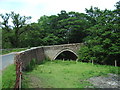
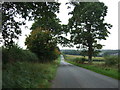

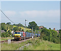
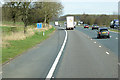
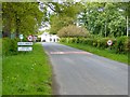
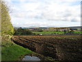
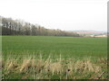
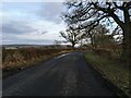
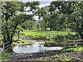
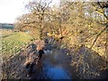
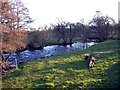
17 photos from this area
Area Information
Key information about the CA11 9QU including its size, population, and administrative classification.
- Area Type
- Postcode
- Area Size
- 14.3 hectares
- Population
- 1344
- Population Density
- 34 people/km²
House Prices in CA11 9QU
25
Properties
£130,000
Average Sold Price
£51,500
Lowest Price
£218,500
Highest Price
Showing 25 properties
| Address | Type | Beds | Baths | Last Sale Price | Last Sale Date | |
|---|---|---|---|---|---|---|
| 7 Bracken Court, Calthwaite, CA11 9QU | Semi-detached | 3 | 1 | £218,500 | Dec 2022 | |
| 1 Bracken Court, Calthwaite, CA11 9QU | Terraced | - | - | £120,000 | Jan 2004 | |
| 2 Bracken Court, Calthwaite, CA11 9QU | Terraced | - | - | £51,500 | Mar 1998 | |
| Calthwaite Hall, Access Road To Houses From The C 1037, Calthwaite, CA11 9QU | Detached | 5 | 7 | - | - | |
| Calthwaite Hall Lodge, Access Road To Houses From The C 1037, Calthwaite, CA11 9QU | Detached | - | - | - | - | |
| 5, Dixon Court, Calthwaite On The C 1037 From Low Wool Oaks To Hallrigg, Calthwaite, CA11 9QU | Semi-detached | 3 | 2 | - | - | |
| 5 Bracken Court, Calthwaite, CA11 9QU | Semi-detached | 3 | 2 | - | - | |
| Calthwaite Hall Farm, Calthwaite On The C 3003 From Thiefside To Landsfoot, Calthwaite, CA11 9QU | Detached | - | - | - | - | |
| 6 Bracken Court, Calthwaite, CA11 9QU | house | - | - | - | - | |
| The Flat, Calthwaite Hall, Access Road To Houses From The C 1037, Calthwaite, CA11 9QU | Flat | - | - | - | - |
Page 1 of 3
Energy Efficiency in CA11 9QU
Amenities
Schools
| Rank | School | Type | Entry gender | Ages |
|---|
Explore more schools in this area
Go to Schools tabDemographics
Household Size
Two person
most common
Accommodation Type
Houses
most common
Tenure
74
majority
Ethnic Group
White
most common
Religion
N/A
most common
Household Composition
N/A
most common
Age
47
median
Adults (30-64 years)
most common
Household Deprivation
N/A
with no deprivation
NS-SEC
36
in Lower managerial occupations
Explore more demographic insights in this area
Go to Demographics tabPlanning
Planning Constraints
- Flood RiskPremium
- Ramsar Wetland SitesPremium
- Area of Outstanding Natural BeautyPremium
- Protected Nature ReservePremium
- Protected WoodlandPremium