Area Overview for CA11 9NW
Photos of CA11 9NW

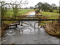
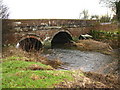


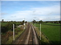
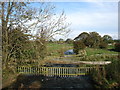
30 photos from this area
Area Information
Key information about the CA11 9NW including its size, population, and administrative classification.
- Area Type
- Postcode
- Area Size
- 1.0 km²
- Population
- 1103
- Population Density
- 53 people/km²
House Prices in CA11 9NW
11
Properties
£320,085
Average Sold Price
£64,500
Lowest Price
£649,425
Highest Price
Showing 11 properties
| Address | Type | Beds | Baths | Last Sale Price | Last Sale Date | |
|---|---|---|---|---|---|---|
| Holme Head, Road From Hasty Bank To Plumpton Head, Bowscar, CA11 9NW | house | - | - | £649,425 | Jul 2021 | |
| Hasty Brow, Bowscar On The C 1037 To Plumpton Hall, Bowscar, CA11 9NW | Detached | 4 | - | £425,000 | Sep 2018 | |
| Low House, Access Road To Denton Cottages, Bowscar, CA11 9NW | Detached | 5 | - | £335,000 | Aug 2017 | |
| Heather Lea, Road From Hasty Bank To Plumpton Head, Bowscar, CA11 9NW | Detached | 6 | 2 | £126,500 | Jan 2002 | |
| 2, Crabtree Cottages, Road From Kitchenhill To Stoneybeck Roundabout, Bowscar, CA11 9NW | Semi-detached | - | - | £64,500 | Sep 1999 | |
| Hasty Bank, Bowscar Road, Bowscar, CA11 9NW | house | - | - | - | - | |
| Milburn House, Bowscar Road, Bowscar, CA11 9NW | Semi-detached | - | - | - | - | |
| Springfield House, Bowscar Road, Bowscar, CA11 9NW | Detached | - | - | - | - | |
| The Flat, Hasty Brow, Bowscar On The C 1037 To Plumpton Hall, Bowscar, CA11 9NW | Flat | - | - | - | - | |
| Riverside House, Road From Hasty Bank To Plumpton Head, Bowscar, CA11 9NW | house | - | - | - | - |
Page 1 of 2
Energy Efficiency in CA11 9NW
Amenities
Schools
| Rank | School | Type | Entry gender | Ages |
|---|
Explore more schools in this area
Go to Schools tabDemographics
Household Size
Two person
most common
Accommodation Type
Houses
most common
Tenure
84
majority
Ethnic Group
White
most common
Religion
N/A
most common
Household Composition
N/A
most common
Age
47
median
Adults (30-64 years)
most common
Household Deprivation
N/A
with no deprivation
NS-SEC
42
in Lower managerial occupations
Explore more demographic insights in this area
Go to Demographics tabPlanning
Planning Constraints
- Flood RiskPremium
- Ramsar Wetland SitesPremium
- Area of Outstanding Natural BeautyPremium
- Protected Nature ReservePremium
- Protected WoodlandPremium