Area Overview for CA11 7EY
Photos of CA11 7EY

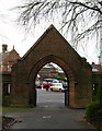
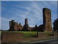
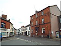

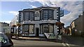
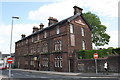
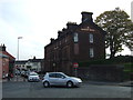

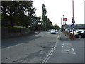
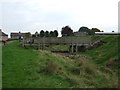
100 photos from this area
Area Information
Key information about the CA11 7EY including its size, population, and administrative classification.
- Area Type
- Postcode
- Area Size
- 1.8 hectares
- Population
- 1335
- Population Density
- 1214 people/km²
House Prices in CA11 7EY
28
Properties
£129,833
Average Sold Price
£56,000
Lowest Price
£167,000
Highest Price
Showing 28 properties
| Address | Type | Beds | Baths | Last Sale Price | Last Sale Date | |
|---|---|---|---|---|---|---|
| 40 Wetheriggs Rise, Penrith, CA11 7EY | house | - | - | £167,000 | Jun 2023 | |
| 34 Wetheriggs Rise, Penrith, CA11 7EY | Semi-detached | 3 | 1 | £163,000 | Apr 2022 | |
| 32 Wetheriggs Rise, Penrith, CA11 7EY | Semi-detached | 2 | 2 | £155,000 | Sep 2021 | |
| 43 Wetheriggs Rise, Penrith, CA11 7EY | house | - | - | £145,000 | Feb 2021 | |
| 42 Wetheriggs Rise, Penrith, CA11 7EY | Semi-detached | 3 | 1 | £157,000 | Apr 2020 | |
| 45 Wetheriggs Rise, Penrith, CA11 7EY | Terraced | 2 | - | £140,500 | Jul 2015 | |
| 54 Wetheriggs Rise, Penrith, CA11 7EY | house | - | - | £129,500 | Mar 2012 | |
| 33 Wetheriggs Rise, Penrith, CA11 7EY | house | 2 | 1 | £130,000 | Jun 2011 | |
| 55 Wetheriggs Rise, Penrith, CA11 7EY | house | 3 | - | £115,000 | Nov 2010 | |
| 39 Wetheriggs Rise, Penrith, CA11 7EY | Semi-detached | - | - | £135,000 | Apr 2005 |
Page 1 of 3
Energy Efficiency in CA11 7EY
Amenities
Schools
| Rank | School | Type | Entry gender | Ages |
|---|
Explore more schools in this area
Go to Schools tabDemographics
Household Size
Two person
most common
Accommodation Type
Houses
most common
Tenure
78
majority
Ethnic Group
White
most common
Religion
N/A
most common
Household Composition
N/A
most common
Age
47
median
Adults (30-64 years)
most common
Household Deprivation
N/A
with no deprivation
NS-SEC
25
in Lower managerial occupations
Explore more demographic insights in this area
Go to Demographics tabPlanning
Planning Constraints
- Flood RiskPremium
- Ramsar Wetland SitesPremium
- Area of Outstanding Natural BeautyPremium
- Protected Nature ReservePremium
- Protected WoodlandPremium