Area Overview for CA11 0QQ
Photos of CA11 0QQ
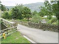
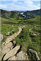
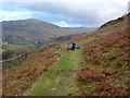
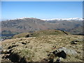
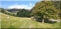
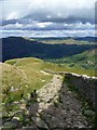
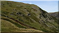
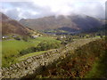
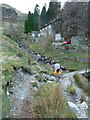
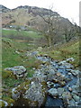
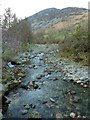
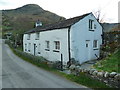
28 photos from this area
Area Information
Key information about the CA11 0QQ including its size, population, and administrative classification.
- Area Type
- Postcode
- Area Size
- 1.2 km²
- Population
- 1363
- Population Density
- 9 people/km²
House Prices in CA11 0QQ
22
Properties
£180,600
Average Sold Price
£60,000
Lowest Price
£410,000
Highest Price
Showing 22 properties
| Address | Type | Beds | Baths | Last Sale Price | Last Sale Date | |
|---|---|---|---|---|---|---|
| Ginnys Cottage, Greenside Road, Glenridding, CA11 0QQ | Semi-detached | 3 | 1 | £410,000 | Jul 2018 | |
| 2, Pendragon Cottage, Access Road To Birkside From Greenside Road, Glenridding, CA11 0QQ | house | - | - | £60,000 | May 2008 | |
| Gillside Cottage, Access Road To Birkside From Greenside Road, Glenridding, CA11 0QQ | Semi-detached | - | - | £215,000 | Aug 2002 | |
| Glendene, Greenside Road, Glenridding, CA11 0QQ | Semi-detached | - | - | £144,000 | Jun 1997 | |
| Blaes Nook, Greenside Road, Glenridding, CA11 0QQ | Terraced | - | - | £74,000 | Jun 1996 | |
| Travellers Rest, Greenside Road, Glenridding, CA11 0QQ | pub | - | - | - | - | |
| The Bungalow, Cuthbert House, Greenside Road, Glenridding, CA11 0QQ | Semi-detached | 6 | 2 | - | - | |
| 2, Birkside, Access Road To Birkside From Greenside Road, Glenridding, CA11 0QQ | Terraced | - | - | - | - | |
| 1, Birkside, Access Road To Birkside From Greenside Road, Glenridding, CA11 0QQ | Semi-detached | - | - | - | - | |
| Caravan Park, Gillside Farm, Access Road To Birkside From Greenside Road, Glenridding, CA11 0QQ | Leisure | - | - | - | - |
Page 1 of 3
Energy Efficiency in CA11 0QQ
Amenities
Schools
| Rank | School | Type | Entry gender | Ages |
|---|
Explore more schools in this area
Go to Schools tabDemographics
Household Size
Two person
most common
Accommodation Type
Houses
most common
Tenure
73
majority
Ethnic Group
White
most common
Religion
N/A
most common
Household Composition
N/A
most common
Age
47
median
Adults (30-64 years)
most common
Household Deprivation
N/A
with no deprivation
NS-SEC
36
in Lower managerial occupations
Explore more demographic insights in this area
Go to Demographics tabPlanning
Planning Constraints
- Flood RiskPremium
- Ramsar Wetland SitesPremium
- Area of Outstanding Natural BeautyPremium
- Protected Nature ReservePremium
- Protected WoodlandPremium