Area Overview for CA11 0NN
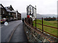
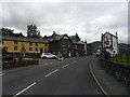
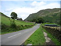
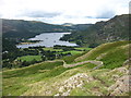
Photos of CA11 0NN
Area Information
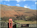
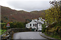
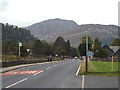
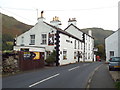
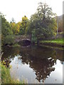
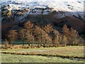
CA11 0NN is a small, rural postcode area in the Lake District, nestled within the Ullswater Valley. Its 9,494 m² footprint accommodates just 1,363 residents, creating a low-density, spread-out community. The area is part of Patterdale, a village steeped in history and linked to the broader Lake District National Park. Daily life here is defined by its rural character, with farming and outdoor pursuits central to the local economy. Proximity to Ullswater Lake offers easy access to water-based activities, while nearby villages like Pooley Bridge and Ambleside provide additional amenities. The area’s historical ties to mining and estate management, such as Patterdale Hall, add to its distinct identity. Residents benefit from a quiet, low-traffic environment, with the surrounding landscape offering scenic walks and a connection to natural heritage. This is a place for those seeking a peaceful, self-sufficient lifestyle, with a strong sense of community rooted in local traditions and the region’s natural beauty.
- Area Type
- Postcode
- Area Size
- 9494 m²
- Population
- 1363
- Population Density
- 9 people/km²
The property market in CA11 0NN is characterised by high home ownership (73%) and a predominance of houses over flats or other property types. This reflects a community focused on long-term residency rather than rental turnover. The small area size and low population density mean housing stock is limited, with properties likely to be larger and more spread out than in urban areas. For buyers, this suggests a market where properties are in demand, particularly for those seeking rural living with access to natural surroundings. The high proportion of owner-occupied homes indicates a stable market, though the small size of the area may limit options for buyers seeking multiple properties or investment opportunities. Proximity to Ullswater and the Lake District National Park adds to the appeal for those prioritising scenic locations.
House Prices in CA11 0NN
Showing 8 properties
Energy Efficiency in CA11 0NN
Life in CA11 0NN revolves around its rural setting and proximity to the Lake District National Park. The nearest amenities include three ferry terminals, enabling access to Ullswater’s waters for boating, walking, and sightseeing. The area’s historical sites, such as Patterdale Hall—a 17th-century estate with holiday homes and woodland—offer opportunities for cultural and outdoor engagement. The King George V playing field, part of the Patterdale Hall Estate, provides recreational space for residents. The village’s character is defined by its farming heritage, with local traditions and natural landscapes shaping daily life. While shops and dining options are limited, the surrounding Lake District offers extensive leisure activities, from hiking to wildlife observation. This is a place where convenience comes from the environment itself, with nature and history as central to the lifestyle.
Amenities
Schools
Residents of CA11 0NN have access to two primary schools: Penruddock Primary School, which holds an Ofsted rating of satisfactory, and Patterdale CofE Primary School, rated good. Both schools serve the local community, offering education for younger children. The presence of a Church of England school alongside a state-funded primary school provides families with choices aligned with different educational preferences. The good rating at Patterdale CofE suggests a strong local institution, while Penruddock’s satisfactory rating indicates areas for improvement. For families, the availability of two schools within practical reach reduces the need for long commutes, supporting a community-focused approach to education.
| Rank | School | Type | Entry gender | Ages |
|---|
Explore more schools in this area
Go to Schools tabDemographics
The population of CA11 0NN is 1,363, with a population density of just 9 people per km², reflecting its rural nature. The median age is 47, with the majority of residents aged between 30 and 64. This suggests a community skewed towards middle-aged adults, likely including retirees and long-term residents. Home ownership is high at 73%, with houses being the predominant accommodation type, indicating a stable, settled population. The predominant ethnic group is White, though specific data on diversity is not provided. The low population density and high home ownership rate suggest a close-knit community with limited pressure on local services. The age profile implies a balance between active professionals and retirees, potentially shaping local amenities and social dynamics.
Household Size
Accommodation Type
Tenure
Ethnic Group
Religion
Household Composition
Age
Household Deprivation
NS-SEC
Explore more demographic insights in this area
Go to Demographics tabPlanning
Planning Constraints
- Flood RiskPremium
- Ramsar Wetland SitesPremium
- Area of Outstanding Natural BeautyPremium
- Protected Nature ReservePremium
- Protected WoodlandPremium