Area Overview for CA11 0HT
Photos of CA11 0HT


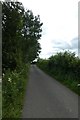
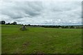

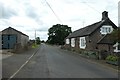
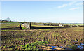


19 photos from this area
Area Information
Key information about the CA11 0HT including its size, population, and administrative classification.
- Area Type
- Postcode
- Area Size
- 1.2 km²
- Population
- 1480
- Population Density
- 50 people/km²
House Prices in CA11 0HT
64
Properties
£201,315
Average Sold Price
£20,000
Lowest Price
£430,000
Highest Price
Showing 64 properties
| Address | Type | Beds | Baths | Last Sale Price | Last Sale Date | |
|---|---|---|---|---|---|---|
| Rivendell, Newbiggin On The C 3019 From The A 66, Newbiggin, CA11 0HT | Detached | 4 | - | £300,000 | May 2025 | |
| Low House, Newbiggin On The C 3019 From The A 66, Newbiggin, CA11 0HT | Detached | 3 | 2 | £430,000 | Mar 2025 | |
| 2 Oak Bank, Newbiggin, CA11 0HT | Detached | 3 | 1 | £210,000 | Dec 2024 | |
| Orchard Cottage, Newbiggin On The C 3019 From The A 66, Newbiggin, CA11 0HT | Detached | 3 | - | £330,000 | Jun 2024 | |
| 14 Oak Bank, Newbiggin, CA11 0HT | house | 3 | 1 | £270,000 | Mar 2024 | |
| 12 Oak Bank, Newbiggin, CA11 0HT | house | - | - | £180,000 | Feb 2023 | |
| 11 Oak Bank, Newbiggin, CA11 0HT | Semi-detached | 3 | 1 | £235,000 | Oct 2022 | |
| 8 Oak Bank, Newbiggin, CA11 0HT | Terraced | 3 | 1 | £192,000 | Oct 2021 | |
| Sunbeam Cottage, Newbiggin On The C 3019 From The A 66, Newbiggin, CA11 0HT | Semi-detached | 3 | 1 | £315,000 | Aug 2021 | |
| 6 Oak Bank, Newbiggin, CA11 0HT | Detached | 3 | - | £205,000 | Jan 2020 |
Page 1 of 7
Energy Efficiency in CA11 0HT
Amenities
Schools
| Rank | School | Type | Entry gender | Ages |
|---|
Explore more schools in this area
Go to Schools tabDemographics
Household Size
Two person
most common
Accommodation Type
Houses
most common
Tenure
80
majority
Ethnic Group
White
most common
Religion
N/A
most common
Household Composition
N/A
most common
Age
47
median
Adults (30-64 years)
most common
Household Deprivation
N/A
with no deprivation
NS-SEC
35
in Lower managerial occupations
Explore more demographic insights in this area
Go to Demographics tabPlanning
Planning Constraints
- Flood RiskPremium
- Ramsar Wetland SitesPremium
- Area of Outstanding Natural BeautyPremium
- Protected Nature ReservePremium
- Protected WoodlandPremium