Area Overview for CA1 3SX
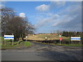
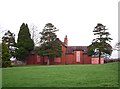
Photos of CA1 3SX
Area Information
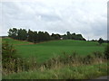
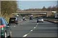
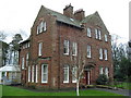
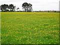
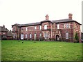
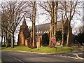
CA1 3SX is a small residential postcode area in St Cuthbert Without, a civil parish in Cumbria, just south of Carlisle city centre. Covering 9 hectares, it is densely populated, with 1,109 residents spread across a compact space, resulting in a population density of 12,335 people per square kilometre. This area blends suburban and semi-rural characteristics, encompassing settlements like Blackwell, Durdar, and Carleton, which transition from historical agricultural land to post-war housing estates. Its proximity to Carlisle offers easy access to urban amenities, while its quieter outskirts provide a more tranquil lifestyle. The area’s history is rooted in 19th-century expansion, with brickworks and early housing developments shaping its character. Today, it is a mature community with a median age of 47, where most residents are homeowners living in houses. Daily life is influenced by its connectivity to major transport routes, including the M6 motorway and nearby rail stations, as well as its proximity to Carlisle’s cultural and commercial hubs.
- Area Type
- Postcode
- Area Size
- 9.0 hectares
- Population
- 1109
- Population Density
- 12335 people/km²
The property market in CA1 3SX is dominated by owner-occupied homes, with 79% of residents living in houses rather than flats or rental properties. This suggests a stable, long-term housing market with limited turnover. The small area size—just 9 hectares—means the housing stock is concentrated, likely comprising a mix of post-war semi-detached and detached homes. As a small postcode area, there is little scope for new development, which could make the market competitive for buyers. The proximity to Carlisle may offer additional options for those seeking larger properties or alternative housing types outside CA1 3SX. For buyers, the high home ownership rate indicates a community that values private property, but the limited space means availability is constrained.
House Prices in CA1 3SX
Showing 7 properties
| Address | Type | Beds | Baths | Last Sale Price | Last Sale Date | |
|---|---|---|---|---|---|---|
| Garlands Clinic And Hospital, Cumwhinton Drive, Carlisle, CA1 3SX | commercial | - | - | - | - | |
| Geltwood House, Carleton Clinic, Cumwhinton Drive, Carlisle, CA1 3SX | office_workshop | - | - | - | - | |
| Westmorland House Ward 24, Carleton Clinic, Cumwhinton Drive, Carlisle, CA1 3SX | Retirement | - | - | - | - | |
| Lloydspharmacy, Pennine Unit, Garlands Clinic And Hospital, Cumwhinton Drive, Carlisle, CA1 3SX | commercial | - | - | - | - | |
| North Lakeland Healthcare Nhs, Acorn Centre, Cumwhinton Drive, Carlisle, CA1 3SX | Retirement | - | - | - | - | |
| Cedarwood, Carleton Clinic, Cumwhinton Drive, Carlisle, CA1 3SX | commercial | - | - | - | - | |
| The Clinic, Carleton Clinic, Cumwhinton Drive, Carlisle, CA1 3SX | commercial | - | - | - | - |
Energy Efficiency in CA1 3SX
Residents of CA1 3SX have access to a range of nearby amenities, including five retail outlets such as Spar, Morrisons Daily, and Co-op Central, ensuring everyday shopping needs are met. The area’s proximity to Carlisle opens up more extensive leisure and dining options, though local facilities are limited to the immediate vicinity. Nearby rail stations, including Carlisle and Wetheral, provide easy access to urban centres, while the M6 and A6 motorways offer connectivity to other regions. The area’s historical and natural features, such as St Mary’s Church in Wreay and Upperby Park, add character to daily life. While the small postcode area itself has limited parks, the surrounding parish includes green spaces and historical sites, offering residents a mix of suburban convenience and semi-rural tranquillity.
Amenities
Schools
| Rank | School | Type | Entry gender | Ages |
|---|
Explore more schools in this area
Go to Schools tabDemographics
The population of CA1 3SX is predominantly adults aged 30–64, with a median age of 47. This suggests a stable, established community with a focus on long-term residency. Home ownership is high, at 79%, indicating a strong preference for private property over rental housing. The area is characterised by houses rather than flats, reflecting a suburban rather than urban housing stock. The predominant ethnic group is White, though specific data on diversity is not provided. The high home ownership rate and mature age profile suggest a community with a strong sense of local identity and continuity. With no data on deprivation levels, it is unclear how this affects access to services, but the area’s proximity to retail, rail, and leisure facilities implies reasonable quality of life for residents.
Household Size
Accommodation Type
Tenure
Ethnic Group
Religion
Household Composition
Age
Household Deprivation
NS-SEC
Explore more demographic insights in this area
Go to Demographics tabPlanning
Planning Constraints
- Flood RiskPremium
- Ramsar Wetland SitesPremium
- Area of Outstanding Natural BeautyPremium
- Protected Nature ReservePremium
- Protected WoodlandPremium