Area Overview for CA1 2SA
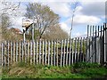
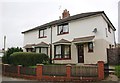
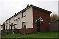
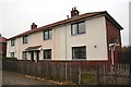
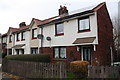
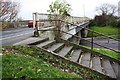
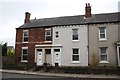
Photos of CA1 2SA

Area Information
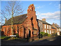
CA1 2SA is a small, densely populated residential area in the north-west of England, nestled within the historic town of Carlisle. Covering just 2,095 square metres, it is a compact cluster of homes serving a community of 2,116 residents. The area’s population density—over 1 million people per square kilometre—reflects its tight-knit, urban character. Once a standalone village, Botcherby, the area was absorbed into Carlisle’s civic boundaries in 1912, retaining traces of its medieval past. Today, it is a practical, no-frills suburb with a focus on accessibility. Residents benefit from proximity to Carlisle’s rail network, including stations at Carlisle, Wetheral, and Dalston, and a nearby airport. Daily life here is shaped by its small size and high density, with amenities clustered closely. While the area lacks sprawling green spaces, its compact layout ensures essentials are within walking or cycling distance. For buyers, CA1 2SA offers a straightforward, functional living environment, though its limited size means choices are constrained.
- Area Type
- Postcode
- Area Size
- 2095 m²
- Population
- 2116
- Population Density
- 1010063 people/km²
The property market in CA1 2SA is characterised by a low home ownership rate of 34%, indicating that most residents are renters rather than homeowners. The area’s primary accommodation type is houses, which is noteworthy given its high population density. This suggests a mix of older, larger properties that may have been converted or subdivided over time. The small size of the area—just 2,095 square metres—means the housing stock is limited, and the immediate surroundings are likely to offer few alternatives. For buyers, this presents challenges: the market is likely competitive, with limited options for purchase. The prevalence of houses may appeal to those seeking more space, but the area’s compact nature means properties are closely packed. Prospective buyers should consider whether the small scale and high density align with their long-term needs.
House Prices in CA1 2SA
No properties found in this postcode.
Energy Efficiency in CA1 2SA
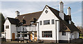
Living in CA1 2SA means daily life is centred around nearby amenities. The retail options include major chains such as Tesco Carlisle, Lidl Carlisle, and Co-op Central, ensuring groceries and essentials are within easy reach. The rail network provides access to Carlisle’s city centre and beyond, with stations at Carlisle, Wetheral, and Dalston offering connections to regional hubs. Carlisle Airport is also nearby, adding to the area’s accessibility. While the area lacks large parks or leisure facilities, its proximity to Carlisle means residents can access cultural and recreational offerings in the town. The compact nature of CA1 2SA means amenities are clustered closely, reducing travel time for errands. However, the absence of local green spaces or entertainment venues within the postcode itself may require trips to nearby towns. The lifestyle here is practical, focused on convenience and connectivity.
Amenities
Schools
| Rank | School | Type | Entry gender | Ages |
|---|
Explore more schools in this area
Go to Schools tabDemographics
The population of CA1 2SA skews towards adults aged 30–64, with a median age of 47. This suggests a community of established professionals and families, rather than students or retirees. Home ownership is relatively low at 34%, indicating that most residents are renters. The predominant accommodation type is houses, which is unusual for a high-density area, suggesting a mix of older, larger properties. The predominant ethnic group is White, though specific diversity data is not provided. The high population density—over a million people per square kilometre—implies a tightly packed, possibly older housing stock. This density may contribute to a sense of community but could also mean limited private space. The age profile and ownership rates suggest a stable, mature demographic, though the area’s small size may limit social diversity.
Household Size
Accommodation Type
Tenure
Ethnic Group
Religion
Household Composition
Age
Household Deprivation
NS-SEC
Explore more demographic insights in this area
Go to Demographics tabPlanning
Planning Constraints
- Flood RiskPremium
- Ramsar Wetland SitesPremium
- Area of Outstanding Natural BeautyPremium
- Protected Nature ReservePremium
- Protected WoodlandPremium