Area Overview for CA1 2NW
Photos of CA1 2NW
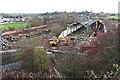


100 photos from this area
Area Information
Key information about the CA1 2NW including its size, population, and administrative classification.
- Area Type
- Postcode
- Area Size
- 6424 m²
- Population
- 1519
- Population Density
- 1628 people/km²
House Prices in CA1 2NW
23
Properties
£103,758
Average Sold Price
£43,500
Lowest Price
£182,700
Highest Price
Showing 23 properties
| Address | Type | Beds | Baths | Last Sale Price | Last Sale Date | |
|---|---|---|---|---|---|---|
| 4, Summerhill, London Road, Carlisle, CA1 2NW | Terraced | 3 | 1 | £182,700 | Aug 2025 | |
| 15, Summerhill, London Road, Carlisle, CA1 2NW | Terraced | 3 | 1 | £140,950 | Oct 2024 | |
| 17, Summerhill, London Road, Carlisle, CA1 2NW | Terraced | 2 | 1 | £137,000 | Aug 2024 | |
| 3, Summerhill, London Road, Carlisle, CA1 2NW | Terraced | 3 | 1 | £117,000 | Oct 2023 | |
| 11, Summerhill, London Road, Carlisle, CA1 2NW | Terraced | 2 | 1 | £137,250 | Oct 2023 | |
| 13, Summerhill, London Road, Carlisle, CA1 2NW | Terraced | 2 | 1 | £132,000 | Jan 2022 | |
| 19, Summerhill, London Road, Carlisle, CA1 2NW | Terraced | 2 | 1 | £125,000 | Jan 2022 | |
| 6, Summerhill, London Road, Carlisle, CA1 2NW | house | - | - | £64,000 | Sep 2021 | |
| 22, Summerhill, London Road, Carlisle, CA1 2NW | Terraced | 3 | - | £129,000 | Oct 2020 | |
| 21, Summerhill, London Road, Carlisle, CA1 2NW | Terraced | 2 | 1 | £67,000 | Jun 2020 |
Page 1 of 3
Energy Efficiency in CA1 2NW
Amenities
Schools
| Rank | School | Type | Entry gender | Ages |
|---|
Explore more schools in this area
Go to Schools tabDemographics
Household Size
One person
most common
Accommodation Type
Houses
most common
Tenure
68
majority
Ethnic Group
White
most common
Religion
N/A
most common
Household Composition
N/A
most common
Age
47
median
Adults (30-64 years)
most common
Household Deprivation
N/A
with no deprivation
NS-SEC
25
in Lower managerial occupations
Explore more demographic insights in this area
Go to Demographics tabPlanning
Planning Constraints
- Flood RiskPremium
- Ramsar Wetland SitesPremium
- Area of Outstanding Natural BeautyPremium
- Protected Nature ReservePremium
- Protected WoodlandPremium