Area Overview for Butt Green
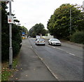
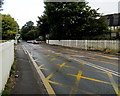
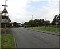
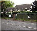
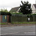
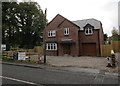
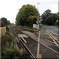
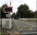
Photos of Butt Green


Area Information
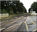
Living in Butt Green offers a blend of practicality and tranquillity within a compact built-up area of 22.5 hectares. Situated in England, this neighbourhood is characterised by its mature demographic, with a median age of 70, suggesting a community rooted in stability and long-term residency. The area’s proximity to Nantwich Railway Station and other nearby stations ensures easy access to regional transport networks, while retail options like Co-op Stapeley, Aldi Nantwich, and Morrisons Nantwich provide essential shopping within walking distance. Butt Green’s low crime risk, reflected in a safety score of 88, underscores its appeal as a secure place to live. While the area lacks detailed data on diversity or deprivation, its high home ownership rate of 85% indicates a settled population. For those seeking a quieter lifestyle with reliable infrastructure, Butt Green’s combination of safety, connectivity, and local amenities makes it a viable choice.
- Area Type
- Built Up Area 250
- Area Size
- 22.5 hectares
- Population
- Not available
- Population Density
- Not available
Butt Green’s lifestyle is shaped by its accessible amenities. Within practical reach are retail outlets such as Co-op Stapeley, Aldi Nantwich, and Morrisons Nantwich, offering a range of shopping options for groceries and daily essentials. The area’s rail connections to Nantwich, Crewe, and Wrenbury stations provide straightforward access to nearby towns, enhancing convenience for travel or commuting. While no parks or leisure facilities are listed in the data, the presence of multiple retail and transport hubs suggests a focus on practicality over expansive recreational spaces. The character of daily life here is likely defined by routine and ease of access, with residents able to meet their needs without long journeys.
Amenities
Schools
| Rank | A + A* % | School | Type | Entry gender | Ages |
|---|
Explore more schools in this area
Go to Schools tabDemographics
Butt Green’s population has a median age of 70, with the most common age range encompassing all demographics. This suggests a community skewed towards older residents, though specific data on household composition or ethnic diversity is not available. Home ownership is exceptionally high at 85%, indicating a predominance of owner-occupied properties. The accommodation types and predominant ethnic groups are not specified in the data, so no conclusions can be drawn about the mix of housing stock or cultural composition. While the area’s age profile may imply a more sedentary lifestyle, the lack of detailed figures on deprivation or income levels means it is unclear how this affects day-to-day quality of life. The data simply confirms a mature, stable population with strong ties to property ownership.
Household Size
Accommodation Type
Tenure
Ethnic Group
Religion
Household Composition
Age
Household Deprivation
NS-SEC
Explore more demographic insights in this area
Go to Demographics tabPlanning
Planning Constraints
- Crime RiskLocked