Area Overview for Burtonwood & Winwick Ward
Photos of Burtonwood & Winwick Ward
Area Information
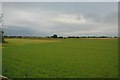
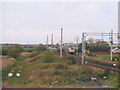
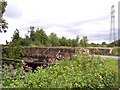
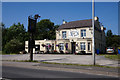
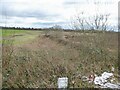
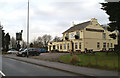
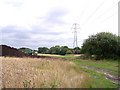
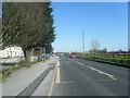
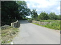
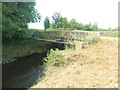
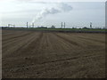
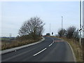
Burtonwood & Winwick Ward is a distinct residential district located within Warrington Unitary Authority in Cheshire, covering an area of 19.5 km². This electoral ward encompasses the village of Burtonwood and the separate village of Winwick, known historically as chapelry and parish sites within the West Derby Hundred of Lancashire. The local landscape supports a population of 1180 residents, creating a very small community density of just 61 people per square kilometre. Daily life here revolves around the specific amenities found in both settlements, including local schools, a Co-operative store, and medical centres. While Burtonwood has a history tied to mining, brewing, and the former RAF station, the current ward functions as a quiet residential zone. You will find yourself in an area defined by vast open spaces rather than urban density. The ward includes three nature reserves, two recreational parks, and woodlands like Wheatacre Woods and Old Colliery Moss. For those considering homes in Burtonwood & Winwick Ward, the scale suggests a peaceful environment where local issues directly affect the community. The villages lie at coordinates approximately 53.4306°N, 2.6295°W, situated near the M62 corridor and connected by various local roads. Living in this ward means relying heavily on specific local transport links, as major interchanges are several miles away.
- Area Type
- District Borough Unitary Ward
- Area Size
- 19.5 km²
- Population
- 1180
- Population Density
- 61 people/km²
Demographics
The community inside Burtonwood & Winwick Ward has a distinctly older demographic profile compared to national averages. Median age data indicates an average of 70 years for residents, suggesting a population dominated by retirees or older families. This age structure aligns with the village setting, where demand is often driven by those seeking quiet contexts rather than thriving city breaks. Out of the total population, 84% of households own their homes outright or via mortgage. This high ownership rate reflects the stable nature of the village life and indicates a long-term commitment to the locality among inhabitants. Household composition and accommodation type figures show a traditional village mix, though specific breakdowns by family size are not detailed in the available records. The ward does not include protected woodlands or designated Ramsar wetland sites within its boundaries, meaning planning constraints related to these specific environmental protections do not apply here. Furthermore, there is no coverage of an Area of Outstanding Natural Beauty or protected nature reserves that would restrict residential expansion. These planning factors, alongside the age profile, shape the character of living in this ward. The diversity figures and religious demographics are not broken out in the provided statistics, so the portrayal relies on these concrete structural facts.
Household Size
Accommodation Type
Tenure
Ethnic Group
Religion
Household Composition
Age
Household Deprivation
NS-SEC
Explore more demographic insights in this area
Go to Demographics tabPlanning
Planning Constraints
- Flood RiskPremium
- Ramsar Wetland SitesPremium
- Area of Outstanding Natural BeautyPremium
- Protected Nature ReservePremium
- Protected WoodlandPremium
- Crime RiskPremium