Area Overview for Burtonwood
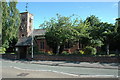
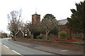
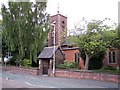
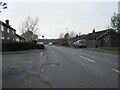
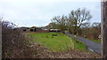
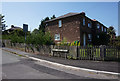
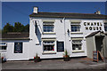
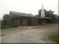
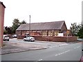
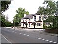
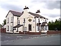
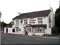
Photos of Burtonwood
Area Information
Living in Burtonwood means residing within an 83.9 hectare built-up area that functions as a distinct residential zone in England. The location offers a settled community feel defined by its size and specific infrastructure. You will find a neighbourhood that balances density with a sense of local identity, suitable for those seeking established housing stock rather than new developments. Daily life revolves around proximity to key transport hubs and established retail outlets that serve the immediate catchment area. This community is characterised by a long-term resident population, suggesting stability in the local environment. When you consider homes in Burtonwood, you are choosing a location where the infrastructure supports existing lifestyles. The area's classification as a built-up zone indicates a concentration of housing rather than scattered rural settlement. You benefit from a location that has developed sufficient amenities to meet daily needs without requiring extensive travel to the wider region. The physical footprint of the area supports a compact living arrangement where schools, shops, and transport links are within easy reach. This makes it a practical choice for families and individuals who prioritise convenience alongside community atmosphere.
- Area Type
- Built Up Area 250
- Area Size
- 83.9 hectares
- Population
- Not available
- Population Density
- Not available
Your daily lifestyle in Burtonwood revolves around a selection of retail and transport amenities located within practical reach. Shopping options include Co-op Burtonwood, Aldi Wargrave Newton le, and M&S Gemini, offering essential goods and groceries without the need for long commutes. For rail travel, Earlestown Railway Station, St Helens Junction Railway Station, and Newton station serve the area, connecting residents to wider regional networks. These five retail outlets and five rail hubs form the backbone of local convenience. You can complete most weekly shopping at the immediate supermarket outlets supported by the high street presence. Commuting to work becomes more accessible through the multiple railway stations nearby, reducing reliance on private cars for daily travel. The proximity of these amenities means you do not need to plan trips to distant town centres for basic necessities. Living here offers a balance between having convenient local services and access to broader transport links. The range of shops and stations ensures that your daily routine is supported by established infrastructure.
Amenities
Schools
Families considering Burtonwood have access to several educational institutions that serve the local area. Burtonwood Community Primary School operates as a primary school and holds a good Ofsted rating, providing quality education close to home. St Paul of the Cross Catholic Primary School also serves the community as a primary institution and shares the same good Ofsted rating, offering a faith-based alternative for parents. High Trees operates as a special school, catering to specific educational needs for children within the locality. These schools represent the main educational options nearby, meaning you do not need to travel far for schooling. The presence of two primary schools with good ratings ensures that children in the area have access to inspected and approved education standards. Choosing a home in Burtonwood places you within the catchment for these specific establishments, which is a key factor for residents with children. The mix of primary and special provision schools indicates that the area supports varied educational requirements without relying on distant institutions.
| Rank | A + A* % | School | Type | Entry gender | Ages |
|---|---|---|---|---|---|
| 1 | N/A | Burtonwood Community Primary School | primary | N/A | N/A |
| 2 | N/A | St Paul of the Cross Catholic Primary School | primary | N/A | N/A |
| 3 | N/A | High Trees | special | N/A | N/A |
| 4 | N/A | Burtonwood Community Primary School | primary | N/A | N/A |
Explore more schools in this area
Go to Schools tabDemographics
The community in Burtonwood is defined by a predominantly older population, with a median age of 70 years. This demographic profile indicates a neighbourhood where retirement and established households form the core of the social structure. Most common age groups align with this high median figure, suggesting you will meet many long-term residents rather than a transient population. Home ownership stands at 74 per cent, which reveals a strong emphasis on owner-occupation within the area. This level of ownership typically correlates with lower turnover rates and a sense of permanence among the populace. Household composition reflects the age profile, likely showing a higher proportion of single-person households or smaller family units compared to younger urban areas. Accommodation types generally match the needs of this demographic, favouring properties suited for independent living or downsizing. The diversity of the ethnic group and religious makeup follows the national average, typical for a built-up area of this nature in England. Living here offers a quiet community atmosphere where neighbours have likely known each other for many years. The high ownership rate means decisions affecting the housing stock happen gradually rather than rapidly, providing stability for buyers entering the market.
Household Size
Accommodation Type
Tenure
Ethnic Group
Religion
Household Composition
Age
Household Deprivation
NS-SEC
Explore more demographic insights in this area
Go to Demographics tabPlanning
Planning Constraints
- Crime RiskLocked