Area Overview for Burscough Bridge & Rufford Ward
Photos of Burscough Bridge & Rufford Ward
Area Information
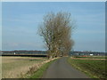
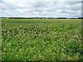
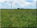
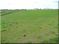
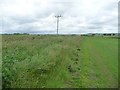
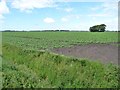
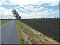
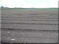
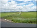
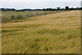
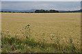
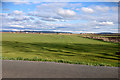
Burscough Bridge & Rufford Ward is an electoral ward within West Lancashire Borough Council located in North West England. This district spans 50.2 km² and sits on a low ridge above the West Lancashire Coastal Plain, positioned to the north of Ormskirk and Skelmersdale. The area encompasses parts of the village of Burscough, including the site of Burscough Bridge, along with the neighbouring civil parish of Rufford. You will find the ward coordinates at 53.61969255367818, -2.843989650144466, placing it firmly in a historical landscape defined by its connection to the Leeds and Liverpool Canal. Daily life here is shaped by deep historical roots and a transition from agricultural and canal-based industries to residential use. The name Burscough derives from the Viking *Burh-skogr*, meaning fortress in the woods, while Burscough Bridge emerged in the mid-18th century around the canal network. Today, the environment offers proximity to significant historical features such as the Ruins of Burscough Priory and the late-19th-century Burscough Wharf complex. Residents benefit from road links via the A59, which connects Liverpool and Preston, and access to railway stations like Burscough Junction and Burscough Bridge. Living in this ward means you are situated near sites of industrial heritage, including a former Ordnance Depot and past manufacturing facilities, now contributing to the local housing stock.
- Area Type
- District Borough Unitary Ward
- Area Size
- 50.2 km²
- Population
- Not available
- Population Density
- Not available
Demographics
The community profile of Burscough Bridge & Rufford Ward is distinctively older than the national average. With a median age of 70, this ward represents a mature population centred on retirement living. The most common age demographic falls under the category of Age: Total, reflecting this older skew. You should expect a neighbourhood where residents are largely established rather than transient. Home ownership is the dominant form of tenure, with 79% of residents owning their properties outright or with a mortgage. This high level of ownership suggests stability within the community. Data indicates that household composition and accommodation types are recorded under total categories, but the overwhelming statistic of ownership shapes the character of the area. The area also exhibits high safety scores, with crime risk rated at 80 out of 100, indicating below-average crime rates compared to other regions. This low crime figure reinforces the appeal of the ward for those seeking a secure environment to retire. There is no presence of AONB coverage or protected nature reserves within the administrative boundary, focusing the local landscape on managed historic and agricultural features rather than designated protected status.
Household Size
Accommodation Type
Tenure
Ethnic Group
Religion
Household Composition
Age
Household Deprivation
NS-SEC
Explore more demographic insights in this area
Go to Demographics tabPlanning
Planning Constraints
- Flood RiskPremium
- Ramsar Wetland SitesPremium
- Area of Outstanding Natural BeautyPremium
- Protected Nature ReservePremium
- Protected WoodlandPremium
- Crime RiskPremium