Area Overview for Burneside
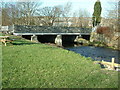
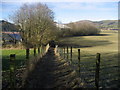
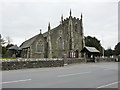
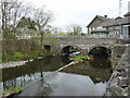
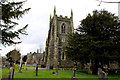
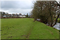
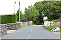
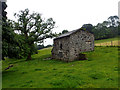
Photos of Burneside
Area Information
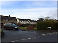
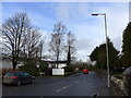
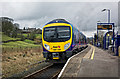
Burneside is a compact built-up area spanning 39.5 hectares, situated in England. Its small size and established character make it a distinct place, where daily life is shaped by proximity to essential services and a relatively low population density. The median age of 70 suggests a community skewed towards older residents, which influences the local atmosphere and pace of life. Despite its modest size, Burneside offers practical access to nearby rail stations, including Burneside Railway Station and Kendal Railway Station, connecting residents to broader regional networks. The area’s safety profile is strong, with a crime risk score of 81, reflecting below-average crime rates. For those considering living in Burneside, the combination of low crime, accessible transport, and proximity to retail and educational facilities makes it a viable choice for those prioritising security and convenience over larger urban amenities. The area’s compact nature ensures that essential services are within practical reach, though its limited size may mean fewer options for those seeking a more expansive lifestyle.
- Area Type
- Built Up Area 250
- Area Size
- 39.5 hectares
- Population
- Not available
- Population Density
- Not available
Burneside’s residents have access to essential retail amenities within practical reach, including Sainsburys Kendal, Morrisons New, and Iceland Kendal. These stores provide a range of shopping options, from groceries to household goods, supporting daily needs without requiring long trips. The area’s rail stations, such as Burneside Railway Station, offer connectivity to nearby towns, enhancing access to additional leisure and cultural opportunities beyond the immediate vicinity. While the data does not mention parks or recreational facilities, the presence of multiple retail outlets and rail links suggests a practical, service-oriented lifestyle. The compact nature of Burneside means amenities are concentrated, reducing travel time but potentially limiting variety. For those valuing convenience over scale, this setup offers a straightforward, efficient daily routine.
Amenities
Schools
The nearest school to Burneside is St Oswald’s CofE Primary School, which serves the local community with a primary education offering. The school holds an Ofsted rating of ‘good’, indicating a satisfactory standard of teaching and facilities. However, the data does not list any secondary schools in the immediate vicinity, which may require families to seek options further afield. This mix of primary and absent secondary education suggests that while young children can access local schooling, older students may need to travel to nearby towns for secondary education. For families prioritising proximity to schools, Burneside’s primary offering is a positive, but the lack of secondary options may be a consideration for those planning long-term in the area.
| Rank | School | Type | Entry gender | Ages |
|---|
Explore more schools in this area
Go to Schools tabDemographics
Burneside’s population is predominantly older, with a median age of 70, indicating a community where retirement is the norm. This age profile shapes local dynamics, with fewer young families and a higher proportion of long-term residents. Home ownership in the area stands at 68%, suggesting a stable housing market where many properties are owner-occupied. The data does not specify household composition or accommodation types, but the high home ownership rate implies a mix of family homes and single-occupancy properties. The absence of detailed figures on diversity or deprivation means the community’s cultural and socioeconomic makeup remains less defined. However, the relatively high home ownership rate and older demographic may indicate a population prioritising stability over mobility. For buyers, this profile suggests a market where properties are likely to remain in the same hands for extended periods, with fewer short-term rental opportunities.
Household Size
Accommodation Type
Tenure
Ethnic Group
Religion
Household Composition
Age
Household Deprivation
NS-SEC
Explore more demographic insights in this area
Go to Demographics tabPlanning
Planning Constraints
- Crime RiskPremium