Area Overview for Burland and Acton
Photos of Burland and Acton


Area Information
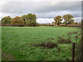
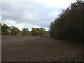
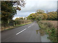
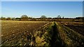
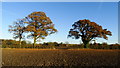
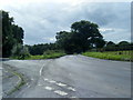
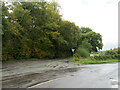
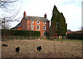
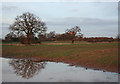
Living in Burland and Acton places you within a civil parish in Cheshire East, covering 13.3 km² of rural landscape. This area sits approximately 2½ miles west of Nantwich, positioned along the A534 road and bordered by the historic Shropshire Union Canal. The location encompasses the village of Burland, along with settlements such as Burland Lower Green, Burland Upper Green, Hollins Green, and parts of Stoneley Green. You will find Grade II-listed landmarks like Swanley Bridge, built around 1793, and Swanley Lock No. 2 from 1805 anchoring the riverside scenery. The community possesses a deep historical底蕴, having evolved from Acton's ancient parish after becoming a separate civil parish in 1866. Architecture here reflects centuries of history, from early 16th-century Swanley Hall to 17th-century thatched cottages and red-brick buildings from the 1870s Peckforton Estate. Today, the parish supports its residents through local stores and a marina that accommodates 300 boats. Life here combines countryside character with the strategic benefits of its canal-side location and association with the wider region of North West England.
- Area Type
- Parish
- Area Size
- 13.3 km²
- Population
- Not available
- Population Density
- Not available
Demographics
The community in Burland and Acton features a distinctly mature population profile. The median age here is 70, indicating that the area caters largely to retirement living or older residents seeking a quieter pace. While specific data regarding household composition and predominant ethnic groups is not detailed in available records, the age demographics suggest a settled, long-term population structure rather than a transient workforce housing scenario. Home ownership levels stand at 79%, which significantly influences the character of the neighbourhood. This high percentage reflects a stable market where most residents live in homes they own outright or have secured mortgages for the long term. Such ownership rates typically correlate with lower turnover and fewer tenant disputes, fostering a predictable living environment. The area does not rely on rental schemes or temporary accommodation figures to sustain its population. Instead, the 79% ownership statistic points to a community invested in their local surroundings, likely contributing to the stability found in settlements like Burland Lower Green and the canal-side villages.
Household Size
Accommodation Type
Tenure
Ethnic Group
Religion
Household Composition
Age
Household Deprivation
NS-SEC
Explore more demographic insights in this area
Go to Demographics tabPlanning
Planning Constraints
- Flood RiskLocked
- Ramsar Wetland SitesLocked
- Area of Outstanding Natural BeautyLocked
- Protected Nature ReserveLocked
- Protected WoodlandLocked
- Crime RiskLocked