Area Overview for Buckshaw & Whittle Ward
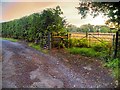
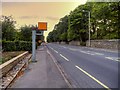
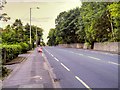
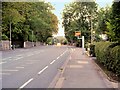
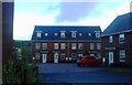
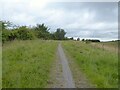
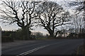
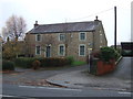
Photos of Buckshaw & Whittle Ward
Area Information
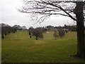
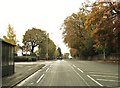
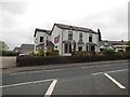
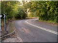
Buckshaw & Whittle Ward occupies a distinct position within the Borough of Bury, covering a compact land area of exactly 4.9 km². As a district borough unitary ward, it functions as a well-defined local community rather than a sprawling municipality. Living in Buckshaw & Whittle Ward often means settling into an environment where residents have established deep roots, evidenced by a median age of 70 years. This demographic profile suggests a neighbourhood dominated by long-term residents and retirees who have grown to know the streets and local services intimately. The small geographical footprint means that daily necessities are likely within easy reach for many households, reducing the need for long commutes or extensive travel within the ward itself. You can expect a setting where the pace of life reflects the age of its inhabitants. The area offers a sense of stability, particularly appealing to those seeking retirement homes or a quiet place to establish a residence for the long term. Because the ward is so geographically contained, the community feel is likely tight-knit, with neighbours often aware of one another over generations. This character defines the daily reality for anyone considering homes in Buckshaw & Whittle Ward. You are buying into a place where the population is settled, the community is mature, and the lifestyle centres on local engagement rather than the transient energy of younger demographics. The distinct identity of this 4.9 km² zone is forged by this specific age profile and its status as a defined administrative unit.
- Area Type
- District Borough Unitary Ward
- Area Size
- 4.9 km²
- Population
- Not available
- Population Density
- Not available
Demographics
The social fabric of Buckshaw & Whittle Ward is defined by a highly stable population structure. You will find that 74% of households in this area own their homes outright or with a mortgage. This high rate of home ownership reflects a community accustomed to long-term residence rather than short-term renting. The demographic profile shows a median age of 70, indicating that the majority of residents are older adults. While the specific breakdown of age ranges is not detailed beyond the total category, the high median age paints a clear picture of an area populated by retirees and seniors. Household composition in Buckshaw & Whittle Ward follows patterns typical of older communities, where families may be downsizing or living alone. The accommodation types present are largely suited to this established population, prioritising tenure stability over transient living arrangements. There is no data available regarding the specific ethnic groups within Buckshaw & Whittle Ward, so the community appears to reflect broader regional demographics rather than distinct minority concentrations. Religion statistics for the ward are similarly undisclosed in the current records. Deprivation levels are not explicitly measured in the provided dataset, but the high home ownership rate and older median age suggest an environment focused on established living standards. When considering schools near Buckshaw & Whittle Ward, parents should note that the area's median age of 70 may mean fewer families with young children reside locally compared to younger neighbourhoods.
Household Size
Accommodation Type
Tenure
Ethnic Group
Religion
Household Composition
Age
Household Deprivation
NS-SEC
Explore more demographic insights in this area
Go to Demographics tabPlanning
Planning Constraints
- Flood RiskPremium
- Ramsar Wetland SitesPremium
- Area of Outstanding Natural BeautyPremium
- Protected Nature ReservePremium
- Protected WoodlandPremium
- Crime RiskPremium