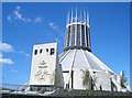
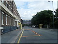
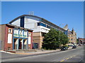
Area Overview for Brownlow Hill Ward
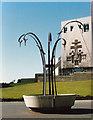
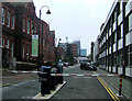
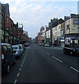
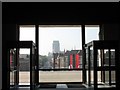
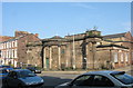
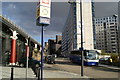
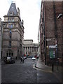
Photos of Brownlow Hill Ward

Area Information
Brownlow Hill Ward is a small but distinct administrative area situated in the central-eastern part of Liverpool. This ward covers exactly 1.0 km² of land and serves as one of the 64 divisions within the unitary authority of Liverpool City Council. Its location places it firmly within the city's core, meaning daily life here is defined by proximity to the wider urban fabric rather than rural isolation. Residents engage with the broader metropolitan services while navigating a ward that operates as a specific planning and governance unit. Living in Brownlow Hill Ward means residing in a compact neighbourhood where the boundary lines are clearly defined on official council maps. The area does not contain designated protected statuses such as Areas of Outstanding Natural Beauty or Ramsar wetland sites, which keeps planning decisions focused on standard urban development constraints instead. You will find yourself in a ward that is purely functional within the city's structure, lacking additional ecological designations that might restrict building in other zones. The character of the ward is shaped entirely by its position within Liverpool rather than by unique geographical features. Shopping, leisure, and transport options rely on the amenities available throughout the city centre and surrounding districts. When you consider homes in Brownlow Hill Ward, you are looking at a location that benefits from being central while maintaining the specific identity of a single, small administrative zone within the larger city framework.
- Area Type
- District Borough Unitary Ward
- Area Size
- 1.0 km²
- Population
- Not available
- Population Density
- Not available
Demographics
The community in Brownlow Hill Ward is notably older than the national average for British areas. The median age of residents is 70 years, indicating a population dominated by older adults. While specific data on the most common age group is recorded simply as "Age: Total", the age profile clearly points towards a retirement or late-life societal structure within this 1.0 km² area. Household composition statistics do not disclose a specific breakdown, so the exact mix of single-person, couples, or families remains unspecified in the available records. Home ownership is extremely low in this ward, with only 12% of households owning their property outright. This figure suggests that the vast majority of residents are private tenants relying on the rental market for accommodation. Consequently, the estate consists primarily of rented flats and housing, with very few freehold properties available locally. This high rental proportion shapes the demographic stability of the area, as tenancy terms rather than long-term ownership drive household movements. There is no specific data available regarding the predominant ethnic group or religious affiliation of the residents within Brownlow Hill Ward. The absence of these specific breakdowns prevents a detailed analysis of cultural diversity in this small ward. However, the housing stock is predominantly rental accommodation, which typically supports a diverse range of tenants exchanging residences frequently. Understanding the age profile is the primary demographic insight available for anyone considering living in Brownlow Hill Ward.
Household Size
Accommodation Type
Tenure
Ethnic Group
Religion
Household Composition
Age
Household Deprivation
NS-SEC
Explore more demographic insights in this area
Go to Demographics tabPlanning
Planning Constraints
- Flood RiskPremium
- Ramsar Wetland SitesPremium
- Area of Outstanding Natural BeautyPremium
- Protected Nature ReservePremium
- Protected WoodlandPremium
- Crime RiskPremium