Area Overview for Brougham
Photos of Brougham
Area Information
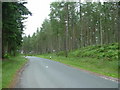
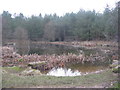
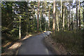
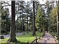
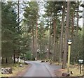
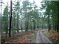
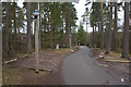
Brougham is a civil parish located in the Eden district of Cumbria, covering a total area of 27.2 square kilometres. You will find this settlement approximately two miles south-east of Penrith, situated near the confluence of the Rivers Lowther and Eamont. The land historically encompassed 6,226 acres before expansion in 1935 included the Winderwath area, bringing the total to 6,729 acres. Our records show the population experienced a notable shift throughout the late 19th and early 20th centuries, declining from 296 in 1881 to 243 in 1931 following boundary changes. Today, daily life in Brougham remains predominantly rural and agricultural, characterised by a low-density feel tied to its ancient heritage. The parish includes distinct areas such as Woodside, Moorhouses, and Hornby. Nearby residents can access the A66 road and are within one and three-quarter miles of Penrith railway station, which serves connections for Lancaster and Carlisle. Local landmarks define the landscape, including the ruins of Brougham Castle, Brougham Hall, and the historical Countess Pillar beside the A66. You live in an environment that preserves sites of Roman, Saxon, and medieval significance alongside the Brocavum Roman fort. This setting offers a quiet existence centred on historical value rather than modern urban density.
- Area Type
- Parish
- Area Size
- 27.2 km²
- Population
- Not available
- Population Density
- Not available
Demographics
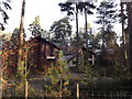
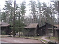
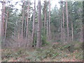
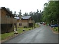
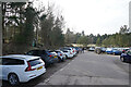
The community in Brougham reflects a mature population profile, with a median age of 70 years. This high figure indicates that the parish is primarily inhabited by older residents. While specific data regarding household composition, predominant ethnic groups, and religious affiliation is not included in current records, the age demographics suggest a quieter, less transient environment compared to younger townships. You are looking at a stable demographic where residents have likely established long-term roots in the area. Home ownership stands at 69 per cent within the parish. This high proportion confirms that the majority of people living in Brougham own their homes outright or have a mortgage. Such statistics typically point to a community focused on retirement or long-term settlement rather than short-term rental markets. The local economy relies mainly on agriculture, forestry plantations, and historical quarrying activities. Former commercial interests include Centre Parcs at Whinfell, which opened as Oasis in 1997, and limited historical military testing at Brougham Hall during the Second World War. No major employers or commercial centres operate directly within the settlement boundaries, reinforcing the agricultural nature of daily life for residents of this civil parish.
Household Size
Accommodation Type
Tenure
Ethnic Group
Religion
Household Composition
Age
Household Deprivation
NS-SEC
Explore more demographic insights in this area
Go to Demographics tabPlanning
Planning Constraints
- Flood RiskPremium
- Ramsar Wetland SitesPremium
- Area of Outstanding Natural BeautyPremium
- Protected Nature ReservePremium
- Protected WoodlandPremium
- Crime RiskPremium