Area Overview for Brock with Catterall Ward
Photos of Brock with Catterall Ward

Area Information
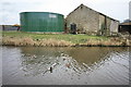
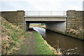
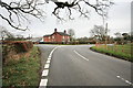
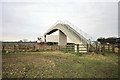
Living in Brock with Catterall Ward places you within the Borough of Wyre in the North West of England. This ward encompasses two distinct settlements, Brock and Catterall, which together form a community of 34.9 square kilometres. The area falls under the Lancaster & Wyre parliamentary constituency and includes postcodes such as PR3 0BF, PR3 0BT, and PR3 0BY. You will find this location in the northern part of the Borough of Wyre, often linked to the broader geography of the Forest of Bowland Area of Outstanding Natural Beauty. Daily life here offers a quiet, rural character defined by its administrative boundaries and lack of urban density. The ward provides a specific setting for those seeking a lifestyle away from major city centres, yet it remains connected through the wider Lancashire county network. Recent records place the area within a reasonable distance of local transport links, including Brock railway station, though specific journey times to major hubs remain unrecorded in current databases. This ward remains a distinct entity for all local governance and postal services.
- Area Type
- District Borough Unitary Ward
- Area Size
- 34.9 km²
- Population
- Not available
- Population Density
- Not available
Demographics
The community profile of Brock with Catterall Ward reveals an older demographic compared to many other parts of England. The median age for residents reaches exactly 70 years, indicating a population heavily weighted towards the senior age group. This age distribution shapes the local economy and social fabric, suggesting a neighbourhood where long-term residents remain settled. Home ownership stands at a robust level of 70 percent, meaning most households have purchased their residences outright or via mortgage. This high rate of ownership contrasts with areas functioned primarily as student or rental markets. While specific data on household composition, predominant ethnic groups, and religious affiliation is not itemised in the current records, the overall picture points to a stable, long-standing settlement. The area does not feature the transient population markers often seen in university towns. Instead, the demographic structure supports a community where families and retirees have established deep roots. This age profile may influence local service provision, from leisure activities to medical support, though specific funding allocations remain outside the scope of this summary.
Household Size
Accommodation Type
Tenure
Ethnic Group
Religion
Household Composition
Age
Household Deprivation
NS-SEC
Explore more demographic insights in this area
Go to Demographics tabPlanning
Planning Constraints
- Flood RiskPremium
- Ramsar Wetland SitesPremium
- Area of Outstanding Natural BeautyPremium
- Protected Nature ReservePremium
- Protected WoodlandPremium
- Crime RiskPremium