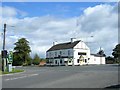
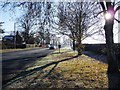
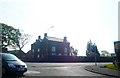
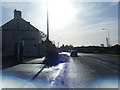
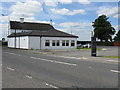
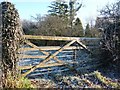
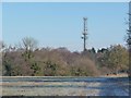
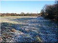
Area Overview for Brereton Rural Ward
Photos of Brereton Rural Ward
Area Information
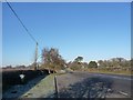
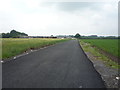
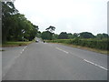
Brereton Rural Ward covers an expansive 99.1 square kilometres within the district borough unitary ward of Cheshire. You are looking at a vast rural expanse where the local environment remains a central feature of daily life. The area is defined by its openness and separation from the denser urban sprawls typical of the surrounding region. Living in Brereton Rural Ward means navigating a landscape that prioritises space and quiet over proximity to urban centres. The significant size of the ward suggests a community where homes are spread out, and travel distances between key services will naturally be considerable. The profile of the area points towards residents who value independence and a traditional countryside lifestyle rather than the fast pace of city living. This setting offers a distinct alternative to coastal villages or town centres, focusing instead on the agricultural and natural assets of the countryside. You will find that the character of Brereton Rural Ward is shaped by its physical layout, which influences everything from local traffic patterns to the types of neighbours you might meet. The sheer scale of the 99.1 km² area ensures that development is not the primary driver of the local landscape, preserving the rural identity that defines life here. When considering homes in Brereton Rural Ward, you must accept that this is a place for those comfortable with rural isolation. The area does not boast a dense network of shops or transit hubs within walking distance. Instead, it relies on the broader infrastructure of the district to connect residents to jobs and culture. This independence comes with the freedom to enjoy the surrounding land without the constraints of strict planning or high-density living. It is a straightforward choice for buyers seeking a established link to the land and a slower rhythm of life.
- Area Type
- District Borough Unitary Ward
- Area Size
- 99.1 km²
- Population
- Not available
- Population Density
- Not available
Demographics
The population of Brereton Rural Ward displays a clear demographic profile marked by advanced age. The median age here reaches 70 years, indicating that the community is significantly older than the national average. This figure confirms that the area is home predominantly to retirees and older households seeking a quiet retirement setting. Nearly every resident falls into an age bracket that reflects this high median, creating a community structure focused on later life needs rather than young families or students. Home ownership stands as the defining feature of the area’s living arrangements. A staggering 83% of households own their property outright or with a mortgage. This high level of ownership suggests a stable community where long-term residents have settled deeply into the locality. You will encounter very few private landlords operating exclusively within Brereton Rural Ward. The dominance of owner-occupied homes reinforces the idea that this is a place for people who intend to stay for retirement. Household composition in the ward aligns with this demographic reality, with families likely consisting of single occupants or couples living together. The low rate of home renting further isolates the community from transient populations. You do not find the typical mix of diverse household types found in urban wards. Instead, the social fabric is woven from established connections between neighbours who have likely lived in the same region for decades. This creates a predictable environment where community expectations and lifestyles are well understood by everyone residing in Brereton Rural Ward.
Household Size
Accommodation Type
Tenure
Ethnic Group
Religion
Household Composition
Age
Household Deprivation
NS-SEC
Explore more demographic insights in this area
Go to Demographics tabPlanning
Planning Constraints
- Flood RiskPremium
- Ramsar Wetland SitesPremium
- Area of Outstanding Natural BeautyPremium
- Protected Nature ReservePremium
- Protected WoodlandPremium