Area Overview for Bothel and Threapland
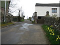
Photos of Bothel and Threapland

Area Information
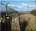
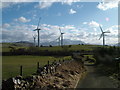
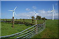
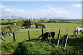
Bothel and Threapland is a civil parish covering an area of 13.7 km² in England. It offers a settled rural environment where daily life revolves around a close-knit community. The locality is defined by its character as a distinct parish rather than a sprawling urban centre. Residents here experience a pace of life that prioritises local interaction and simplicity. Those considering living in Bothel and Threapland find a setting that balances isolation with accessibility. The small geographic footprint means neighbours are often nearby, fostering familiar surroundings. You will not find large retail parks or major transport hubs directly within the parish boundaries. Instead, the area provides a tranquil backdrop for country living. The landscape supports a quiet existence far removed from city congestion. Homebuyers seeking privacy and space will appreciate the open nature of this parish. The community maintains its identity through low-density development patterns typical of the region. This makes the area suitable for those who value stillness over urban convenience.
- Area Type
- Parish
- Area Size
- 13.7 km²
- Population
- Not available
- Population Density
- Not available
Demographics
The community in Bothel and Threapland reflects a mature population profile with a median age of 70 years old. This indicates that the area skews significantly towards older residents compared to national averages. The most common age range data simply records the total population figure, confirming the village status. You are significantly more likely to find retirees than young families or students living in Bothel and Threapland. Home ownership stands at 82 per cent, showing that the vast majority of residents buy their properties. This high rate of owner occupation suggests long-term settlement rather than temporary renting. The provided data does not specify predominant ethnicity or religious affiliation, but the demographic leanings point to an established local population. Household composition details are recorded for the total figure, reflecting the stable nature of the residents. Life here is geared towards the needs of older adults, with services likely adapted accordingly. The low turnover of families contributes to a consistent community atmosphere. Anyone moving to homes in Bothel and Threapland should expect older demographics as the norm.
Household Size
Accommodation Type
Tenure
Ethnic Group
Religion
Household Composition
Age
Household Deprivation
NS-SEC
Explore more demographic insights in this area
Go to Demographics tabPlanning
Planning Constraints
- Flood RiskPremium
- Ramsar Wetland SitesPremium
- Area of Outstanding Natural BeautyPremium
- Protected Nature ReservePremium
- Protected WoodlandPremium
- Crime RiskPremium