Area Overview for Blacon Ward
Photos of Blacon Ward
Area Information
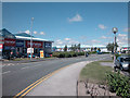
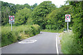
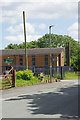
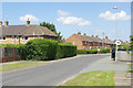
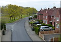
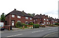
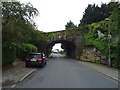
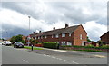
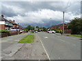
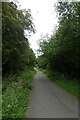
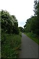
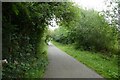
Blacon Ward offers a distinct quiet生活的 edge to life in Cheshire West and Chester, situated one mile north-west of Chester city centre. This electoral ward covers an area of 5.1 square kilometres and serves as a suburban district for 2,667 residents. You will find yourself living on a hill that overlooks the city and the Welsh hills, placing you adjacent to the Welsh border. The landscape is defined by open countryside that surrounds the main residential zones. Blacon Ward sits on high ground near Blacon Point, a location historically significant for its position near a former curve of the River Dee. The area developed significantly after the Second World War, with a large social housing estate constructed between 1948 and 1968 on former farmland. This post-war suburban estate covers 1.2 square miles and forms the core of where families live today. While the ward carries a historical reputation as a deprived area, recent improvement efforts have yielded positive results for local residents. The site of the former Blacon Hall, which was destroyed during the English Civil War, now stands as a notable feature of the land. A 1930s golf course was once located here before a World War II Army camp built over it closed in 1960. Living in Blacon Ward means enjoying proximity to Chester while surrounded by historical land and green spaces.
- Area Type
- District Borough Unitary Ward
- Area Size
- 5.1 km²
- Population
- 2667
- Population Density
- 524 people/km²
Demographics
The community in Blacon Ward reflects a specific settlement pattern driven by its post-war origins. Half of all residents own their homes, indicating a split market between owners and renters. The median age for people living in Blacon Ward is 70 years. This figure highlights a population that skews much older than the national average. Most households are simply households, a broad category that encompasses various family structures when exact breakdowns are not specified in the available records. The ward statistics do not specify the most common age range in detail beyond this high median. You can expect a neighbourhood where older residents form a significant part of the community landscape. Home ownership stands at exactly 50%, meaning half of the population rents or lives rent-free. This balance suggests a diverse range of tenancy types within the 2,667 people who call this ward home. The demographic profile indicates an area where life moves at a different pace compared to younger, more transient urban zones. Residents navigate a community shaped by decades of social housing development and subsequent regeneration efforts that have tried to reverse earlier perceptions of deprivation.
Household Size
Accommodation Type
Tenure
Ethnic Group
Religion
Household Composition
Age
Household Deprivation
NS-SEC
Explore more demographic insights in this area
Go to Demographics tabPlanning
Planning Constraints
- Flood RiskPremium
- Ramsar Wetland SitesPremium
- Area of Outstanding Natural BeautyPremium
- Protected Nature ReservePremium
- Protected WoodlandPremium
- Crime RiskPremium