Area Overview for Blackburn South East Ward
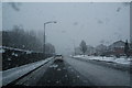
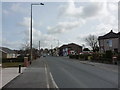
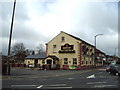
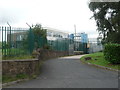
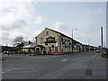
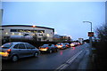
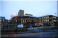
Photos of Blackburn South East Ward

Area Information
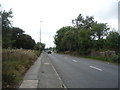
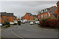
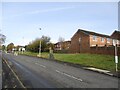
Living in Blackburn South East Ward offers a distinct experience within the Blackburn with Darwen unitary authority. This electoral ward covers an area of 4.5 km² along the southern edge of Blackburn town. It includes residential localities around Fishmoor Drive, Moorgate, and areas near Lower Darwen. The ward sits on the southern edge of Blackburn, which lies north of the West Pennine Moors. You are situated approximately 9 miles east of Preston and 21 miles north-northwest of Manchester. The population of Blackburn South East Ward stands at 1,655 residents. This small population spread across the land results in a density of 370 people per km². This level of density suggests a community with more space than high-rise city centres but within a nearby built-up environment. The postcode BB1 1XG marks a specific location on the southern access routes. You live in an area with key junctions nearby. Access to the M65 motorway is proximate with junctions at the eastern edge near Intack. South accesses at J5 near Guide and J4 near Lower Darwen are also close. The west-north direction connects you to the A59 midway between Blackburn and Preston. Daily life here involves navigating this network of roads and understanding your position relative to the broader Lancashire region.
- Area Type
- District Borough Unitary Ward
- Area Size
- 4.5 km²
- Population
- 1655
- Population Density
- 370 people/km²
Demographics
The community in Blackburn South East Ward displays a clear demographic profile. The median age of residents is 70 years old. This indicates a significant presence of older adults within the ward. Data shows the most common age range falls under the label "Age: Total". Home ownership levels are recorded at 43 per cent. This figure describes the proportion of households that own their property outright or with a mortgage. You can expect a mix of occupied and owner-occupied households based on this statistic. Household composition and accommodation type data are listed as "total" in the available records. Predominant ethnic groups and religion data are also recorded generally without specific breakdowns for this ward. The high median age suggests a settlement pattern often found in areas approaching retirement or housing the elderly. This age profile influences local demands for services and housing types. The low population figure of 1,655 reinforces the community feel of this small electoral ward. You are living amongst a demographic where life stages lean heavily towards older age groups. This context is vital for anyone considering the social environment of Blackburn South East Ward.
Household Size
Accommodation Type
Tenure
Ethnic Group
Religion
Household Composition
Age
Household Deprivation
NS-SEC
Explore more demographic insights in this area
Go to Demographics tabPlanning
Planning Constraints
- Flood RiskPremium
- Ramsar Wetland SitesPremium
- Area of Outstanding Natural BeautyPremium
- Protected Nature ReservePremium
- Protected WoodlandPremium
- Crime RiskPremium