Area Overview for BL9 9ZW
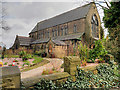
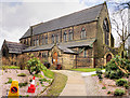
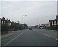
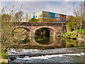
Photos of BL9 9ZW
Area Information
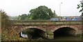
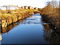
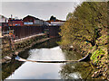
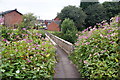
BL9 9ZW is a small residential cluster in the Metropolitan Borough of Bury, Greater Manchester, nestled between the Parr Brook and Whittle Brook. With a population of 1,734, this area reflects a quiet, established community shaped by post-Industrial Revolution development and 1950s urbanisation. Its proximity to the A56 arterial road via Sunny Bank Road ensures easy access to Bury and Manchester, while the surrounding high ground offers a sense of seclusion. Historically part of Lancashire, Unsworth’s name derives from Old English, hinting at its medieval roots as a place of hounds. Today, the area is characterised by a mix of residential housing and former industrial sites, with Sunny Bank Road linking to key transport routes. Living here means balancing a tranquil, low-density environment with connectivity to urban amenities. The area’s compact size and proximity to Bury’s infrastructure make it appealing for those seeking a quieter alternative to city life, though its small footprint means limited local amenities.
- Area Type
- Postcode
- Area Size
- Not available
- Population
- 1734
- Population Density
- Not available
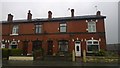
BL9 9ZW is a predominantly owner-occupied area, with 75% of properties owned by residents rather than rented. The accommodation type is exclusively houses, indicating a lack of high-density housing or apartment blocks. This suggests a market focused on family homes and long-term investment rather than short-term rental opportunities. The small size of the area means the housing stock is limited, with properties likely to be older, reflecting post-war development and former industrial sites repurposed for residential use. For buyers, this presents a niche market with limited competition but potential for capital growth in a stable, low-risk environment. However, the lack of new developments or modern housing may appeal to those seeking character homes or historical properties. Proximity to transport links like the A56 and rail stations adds value, though the area’s small size means buyers must consider nearby suburbs for additional options.
House Prices in BL9 9ZW
No properties found in this postcode.
Energy Efficiency in BL9 9ZW
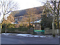
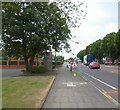
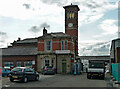
Residents of BL9 9ZW have access to a range of amenities within walking or short driving distance. Retail options include Asda Blackford and two Morrisons Daily stores, offering convenience for groceries and everyday needs. The area’s transport links to Radcliffe, Bury, and Bury Interchange provide access to larger shopping centres, cafes, and cultural venues. Rail stations at Clifton, Kearsley, and Farnworth connect to Manchester and beyond, supporting both commuting and leisure travel. While the area itself has limited parks or green spaces, its proximity to Bury’s urban amenities compensates. The character of daily life is shaped by a blend of local convenience and regional connectivity, making it ideal for those who value self-sufficiency without isolation. The mix of retail, transport, and road access ensures a practical, if modest, lifestyle.
Amenities
Schools
| Rank | School | Type | Entry gender | Ages |
|---|
Explore more schools in this area
Go to Schools tabDemographics
The population of BL9 9ZW has a median age of 47, with the majority of residents aged between 30 and 64. This suggests a community of working-age adults, likely with established careers and families. Home ownership is high, at 75%, indicating a stable, long-term resident base. The area is predominantly composed of houses rather than flats, reflecting a suburban or semi-rural character. The predominant ethnic group is White, though specific data on diversity or minority representation is not provided. The age profile and ownership figures suggest a mature, settled population with a focus on family living. While no deprivation data is available, the high home ownership rate implies a relatively affluent community. The absence of younger demographics or student populations means the area is less likely to experience rapid change or transient populations.
Household Size
Accommodation Type
Tenure
Ethnic Group
Religion
Household Composition
Age
Household Deprivation
NS-SEC
Explore more demographic insights in this area
Go to Demographics tabPlanning
Planning Constraints
- Flood RiskPremium
- Ramsar Wetland SitesPremium
- Area of Outstanding Natural BeautyPremium
- Protected Nature ReservePremium
- Protected WoodlandPremium