Area Overview for BL9 9JU
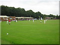
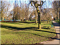
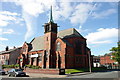
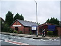
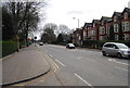
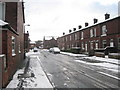
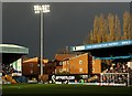
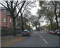
Photos of BL9 9JU
Area Information
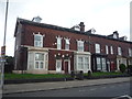
BL9 9JU occupies a specific residential cluster in Redvales, a district located to the south of Bury town centre in Greater Manchester. This postcode covers a small area of 2.8 hectares, yet it accommodates a population of 1,697 people. The location is defined by its proximity to Manchester Road and the River Irwell, areas crossed by Radcliffe Road, Redvales Road and Tarn Drive. The space represents a typical suburban character found in post-industrial Lancashire towns, blending built-up development with natural features near the water. Living in BL9 9JU means residing in an area shaped by significant history. The neighbourhood sits near the site of Bury's first workhouse, built in 1775, and was once home to the Bury Golf Club from 1890 to 1918, where professional golfer Harry Vardon worked. Today, the RAD1 postcode serves as a quiet residential zone where families and mature residents establish their lives. The area captures the essence of the Redvales ward, which encompassed approximately 11,483 people in 2011, though the specific vicinity of this postcode hosts a tighter community of around 1,862 residents. Prospective buyers find a compact environment that balances historical depth with modern suburban convenience without the noise of the industrial past.
- Area Type
- Postcode
- Area Size
- 2.8 hectares
- Population
- 1697
- Population Density
- 1985 people/km²
The property market in BL9 9JU is dominated by owner-occupied homes, with 71 percent of households in the immediate area owning their homes free and clear or with a mortgage. This high ownership rate defines the character of the neighbourhood and influences the type of transactions that occur here. The vast majority of accommodation available consists of houses, ranging from semi-detached family homes to traditional mill cottages located close to the River Irwell. For buyers considering homes in BL9 9JU, the market presents a stock designed for family life rather than high-density living. The presence of detached and semi-detached properties offers privacy and garden space that are rare in more urbanised parts of Bury. Since the area is a specific residential cluster within the larger Redvales ward, selling times may vary compared to town centres. The focus on house types means that purchasers looking for apartments or flats will find very limited options in the immediate BL9 9JU boundary. Investors should note that the 71 percent ownership figure suggests a market where equity holding is high, potentially making the local economy stable and less volatile to market fluctuations. The housing stock remains consistent with the post-industrial residential character established decades ago.
House Prices in BL9 9JU
Showing 17 properties
| Address | Type | Beds | Baths | Last Sale Price | Last Sale Date | |
|---|---|---|---|---|---|---|
| 26 Caton Close, Bury, BL9 9JU | Detached | 6 | 3 | £575,000 | Oct 2025 | |
| 16 Caton Close, Bury, BL9 9JU | Detached | 4 | 2 | £300,000 | Aug 2025 | |
| 34 Caton Close, Bury, BL9 9JU | Detached | 3 | 1 | £1,200 | Oct 2018 | |
| 14 Caton Close, Bury, BL9 9JU | Detached | 3 | - | £186,000 | Oct 2014 | |
| 18 Caton Close, Bury, BL9 9JU | Detached | 4 | - | £185,000 | Jul 2013 | |
| 30 Caton Close, Bury, BL9 9JU | Detached | 3 | 1 | £134,500 | Feb 2004 | |
| 28 Caton Close, Bury, BL9 9JU | Detached | - | - | £120,000 | Sep 2002 | |
| 22 Caton Close, Bury, BL9 9JU | Detached | - | - | £79,000 | Jul 1999 | |
| 2 Caton Close, Bury, BL9 9JU | Detached | - | - | £102,000 | Jul 1999 | |
| 8 Caton Close, Bury, BL9 9JU | house | - | - | £59,000 | Sep 1995 |
Energy Efficiency in BL9 9JU
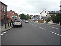
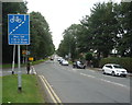
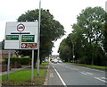
Living in BL9 9JU offers convenient access to a range of retail and transport amenities within practical reach of your home. Local shopping needs are met by five retail outlets, including Morrisons Daily, Heron Bury, and Asda Bury. These supermarkets provide daily groceries and household essentials without the need for long journeys into town. Connectivity is supported by five metro locations near BL9 9JU, such as Bury and Bury Interchange. Rail travel is facilitated by stations like Kearsley Railway Station, Farnworth Railway Station, and Clifton Railway Station. These five rail and five metro points create a layered transport network that simplifies daily commuting. Residents can walk or take short shuttle services to these hubs. The area's character is rooted in its history as a residential district south of Bury town centre. You will find the convenience of local high streets alongside the quiet of riverside homes. The presence of multiple stores and transport nodes means that your daily life balances suburban tranquility with urban accessibility. There is no need for extensive travel to secure basic services or public transport links.
Amenities
Schools
Families living in BL9 9JU have access to several primary institutions located within practical reaching distance. The Derby High School operates as a primary school with an Ofsted rating of good. St Gabriel's RC High School, which functions as a voluntary academy, also holds a good Ofsted rating. This institution provides a dedicated educational environment for local children. Bury Church of England High School serves as both a primary institution and an academy. This school currently holds a satisfactory Ofsted rating. St Gabriel's RC High School, a Voluntary Academy, operates separately from the first entry with the same good rating classification. The mix of academies and community schools offers families different educational approaches. No data provides specific catchment zone details for each school, so proximity drives the choice for most residents. The presence of multiple primary options ensures that you do not need to travel far to secure education. The combination of good-rated academies and the satisfactory-rated Church of England option provides a spread of educational quality. Parents should verify current admission criteria directly with the schools, as intake numbers can fluctuate. The availability of two schools with good ratings suggests a generally strong educational performance in the immediate vicinity of BL9 9JU.
| Rank | School | Type | Entry gender | Ages |
|---|
Explore more schools in this area
Go to Schools tabDemographics
The community living in BL9 9JU is distinguished by a mature population profile. The median age for residents is 47 years, with the most common age range being adults between 30 and 64 years. This demographic skew towards middle age suggests a neighbourhood where stability is a priority. The area shows a strong preference for home ownership, with 71 percent of households owning their property. This figure indicates a settled community less likely to have high levels of short-term tenancies. Accommodation in BL9 9JU consists primarily of houses, reflecting the traditional suburban layout of the district. The housing stock includes semi-detached properties and traditional mill cottages situated near the River Irwell. The predominant ethnic group in the area is White, aligning with the broader demographic patterns of Greater Manchester. You will find a neighbourhood where long-term residents have established deep roots. The high ownership rate combined with the prevalence of house types creates an environment suited for families seeking permanence over the transient nature of student or rental markets common in university towns. This demographic profile supports a quiet domestic atmosphere rather than a bustling youth culture.
Household Size
Accommodation Type
Tenure
Ethnic Group
Religion
Household Composition
Age
Household Deprivation
NS-SEC
Explore more demographic insights in this area
Go to Demographics tabPlanning
Planning Constraints
- Flood RiskPremium
- Ramsar Wetland SitesPremium
- Area of Outstanding Natural BeautyPremium
- Protected Nature ReservePremium
- Protected WoodlandPremium