Area Overview for BL9 9FR
Photos of BL9 9FR
Area Information
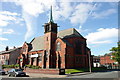
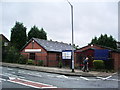
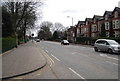
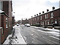
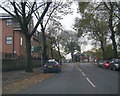
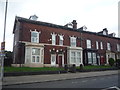
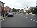
BL9 9FR is a small residential postcode area in England, encompassing a cluster of homes in the southern part of Bury, Greater Manchester. With a population of just 1,985, it reflects the suburban character typical of post-industrial Lancashire towns. The area lies between Manchester Road and the River Irwell, bounded by roads like Radcliffe Road and Tarn Drive. Historically, it was home to Bury’s first workhouse, built in 1775, and later hosted Bury Golf Club until 1918. Today, it is a quiet residential district with semi-detached housing and traditional mill cottages near the river. The area’s compact size means most amenities are within practical reach, though its small population suggests a tight-knit community. For buyers, BL9 9FR offers a mix of older properties and proximity to Bury’s town centre, with a focus on family-friendly living. Its location near transport hubs and schools makes it appealing for those seeking a balance between suburban calm and urban accessibility.
- Area Type
- Postcode
- Area Size
- Not available
- Population
- 1985
- Population Density
- 7959 people/km²
BL9 9FR is predominantly a home-owning area, with 68% of properties owned by residents rather than rented. The accommodation type is primarily houses, which are more common than flats or apartments in this postcode. This suggests a suburban, family-focused housing stock, with semi-detached homes and traditional mill cottages near the River Irwell. Given the area’s small size, the housing market is limited, and buyers may need to look beyond BL9 9FR for a wider selection. The high home ownership rate indicates a stable market, though the absence of rental data means it’s unclear how much of the housing is available for tenants. For those seeking a home here, the focus is on established properties rather than new builds, with potential for long-term value retention in a low-risk environment.
House Prices in BL9 9FR
No properties found in this postcode.
Energy Efficiency in BL9 9FR
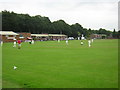
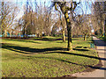
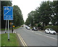
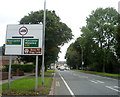
BL9 9FR offers a blend of suburban convenience and proximity to urban amenities. Nearby retail options include Morrisons Daily, Asda Bury, and Heron Bury, providing essential shopping for households. The area’s transport links—via metro, rail, and multiple stations—ensure easy access to Bury’s town centre and beyond. While parks and green spaces are not explicitly listed, the presence of the River Irwell and historical references to mill cottages suggest natural elements are part of the local character. The compact layout means most amenities are within walking or short driving distance, supporting a lifestyle that balances daily needs with a quieter, residential environment. The mix of retail, transport, and historical features contributes to a practical yet distinctive living experience in this small postcode area.
Amenities
Schools
Residents of BL9 9FR have access to three primary schools within practical reach: Fishpool Infant School, St Chad’s Church of England Junior School, and St Luke’s CofE Primary School. The latter holds an Ofsted rating of ‘good’, indicating a solid educational standard. All three schools cater to younger children, providing options for families with primary-age dependents. The absence of secondary schools in the immediate area means students may need to travel to Bury or surrounding towns for secondary education. However, the concentration of primary schools suggests a community-oriented approach to early education, with religious affiliations represented in two of the institutions. For families prioritising primary schooling, BL9 9FR offers multiple choices, though secondary education planning would require additional research.
| Rank | School | Type | Entry gender | Ages |
|---|
Explore more schools in this area
Go to Schools tabDemographics
The population of BL9 9FR is 1,985, with a median age of 47 and the majority of residents aged between 30 and 64. This suggests a community skewed towards middle-aged adults, likely with established careers and families. Home ownership in the area is high at 68%, indicating a stable, long-term resident base. The predominant accommodation type is houses, reflecting a suburban layout rather than high-density living. The largest ethnic group is the Asian community, which shapes the cultural fabric of the area. While specific data on deprivation is absent, the high home ownership rate and presence of family-oriented amenities imply a relatively stable quality of life. However, the lack of detailed socioeconomic breakdowns means broader conclusions about deprivation or affluence remain unconfirmed.
Household Size
Accommodation Type
Tenure
Ethnic Group
Religion
Household Composition
Age
Household Deprivation
NS-SEC
Explore more demographic insights in this area
Go to Demographics tabPlanning
Planning Constraints
- Flood RiskPremium
- Ramsar Wetland SitesPremium
- Area of Outstanding Natural BeautyPremium
- Protected Nature ReservePremium
- Protected WoodlandPremium