Area Overview for BL9 9FJ
Photos of BL9 9FJ
Area Information
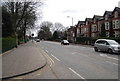
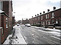
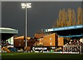
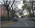
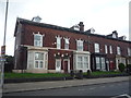
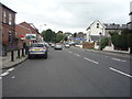
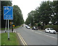
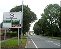
BL9 9FJ is a small residential postcode area in Greater Manchester, nestled within the Redvales district to the south of Bury town centre. With a population of 1,786, it reflects the suburban character of post-industrial Lancashire, where semi-detached housing and traditional mill cottages near the River Irwell define the landscape. The area’s history is steeped in local heritage, from the 1775 Redvales workhouse to the Bury Golf Club, which once hosted professional golfer Harry Vardon. Today, BL9 9FJ offers a quiet, low-density living environment, distinct from the bustling urban core of Bury. Its proximity to Manchester Road and Radcliffe Road ensures connectivity to nearby amenities, while its smaller size fosters a close-knit community feel. For those seeking a balance between historical roots and modern convenience, BL9 9FJ provides a snapshot of a residential district shaped by industrial past and suburban present.
- Area Type
- Postcode
- Area Size
- Not available
- Population
- 1786
- Population Density
- 2979 people/km²
BL9 9FJ is predominantly an owner-occupied area, with 62% of residents living in their own homes. The accommodation type is primarily houses, most likely semi-detached, reflecting the suburban layout typical of post-industrial Lancashire. This contrasts with high-density rental markets, suggesting a focus on private property rather than transient tenancies. The presence of traditional mill cottages near the River Irwell adds historical character to the housing stock, while the semi-detached nature of much of the area implies a balance between privacy and community proximity. For buyers, this small postcode area offers a limited number of properties, potentially increasing competition. The local market is likely influenced by the area’s historical significance and connectivity to Bury’s infrastructure, making it appealing to those seeking a quieter, established residential environment.
House Prices in BL9 9FJ
No properties found in this postcode.
Energy Efficiency in BL9 9FJ
BL9 9FJ offers a range of amenities within practical reach, including retail options like Morrisons Daily, Asda Blackford, and Heron Bury, ensuring everyday shopping needs are met. The area’s proximity to metro stations—Bury, Bury Interchange, and Bury Bolton Street—facilitates easy access to urban centres, while rail stations such as Clifton, Kearsley, and Farnworth connect residents to broader networks. Though the area’s character is defined by semi-detached housing and traditional mill cottages, its location near the River Irwell adds a touch of natural appeal. The mix of retail, transport, and historical architecture creates a lifestyle that balances convenience with a sense of local identity. Residents can enjoy a blend of suburban tranquillity and connectivity to Bury’s amenities, making daily life practical and accessible.
Amenities
Schools
| Rank | School | Type | Entry gender | Ages |
|---|
Explore more schools in this area
Go to Schools tabDemographics
The population of BL9 9FJ is 1,786, with a median age of 47, indicating a mature demographic skewed toward adults aged 30–64. This age group constitutes the most common cohort, reflecting a community likely composed of established professionals and families. Home ownership rates stand at 62%, suggesting a stable, owner-occupied market with a focus on long-term residency. The predominant accommodation type is houses, typically semi-detached, aligning with the area’s suburban character. The predominant ethnic group is White, though specific diversity metrics are not provided. The relatively low population density and higher home ownership suggest a community prioritising private living over rental tenures. While no deprivation data is explicitly stated, the demographic profile implies a population with established careers and family structures, potentially influencing local services and amenities.
Household Size
Accommodation Type
Tenure
Ethnic Group
Religion
Household Composition
Age
Household Deprivation
NS-SEC
Explore more demographic insights in this area
Go to Demographics tabPlanning
Planning Constraints
- Flood RiskPremium
- Ramsar Wetland SitesPremium
- Area of Outstanding Natural BeautyPremium
- Protected Nature ReservePremium
- Protected WoodlandPremium