Area Overview for BL9 8PN
Photos of BL9 8PN
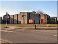
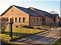
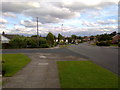
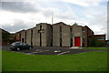
21 photos from this area
Area Information
Key information about the BL9 8PN including its size, population, and administrative classification.
- Area Type
- Postcode
- Area Size
- 1.5 hectares
- Population
- 1534
- Population Density
- 402 people/km²
House Prices in BL9 8PN
23
Properties
£221,056
Average Sold Price
£78,000
Lowest Price
£455,000
Highest Price
Showing 23 properties
| Address | Type | Beds | Baths | Last Sale Price | Last Sale Date | |
|---|---|---|---|---|---|---|
| 7 Kennedy Drive, Bury, BL9 8PN | Bungalow | 2 | 1 | £275,000 | Oct 2024 | |
| 23 Kennedy Drive, Bury, BL9 8PN | Bungalow | 4 | 2 | £455,000 | Nov 2023 | |
| 14 Kennedy Drive, Bury, BL9 8PN | Bungalow | - | - | £260,000 | Jul 2021 | |
| 16 Kennedy Drive, Bury, BL9 8PN | Bungalow | 3 | 2 | £220,000 | Jan 2021 | |
| 6 Kennedy Drive, Bury, BL9 8PN | Bungalow | 3 | 2 | £379,000 | Jul 2019 | |
| 19 Kennedy Drive, Bury, BL9 8PN | Bungalow | 3 | 2 | £262,500 | Mar 2018 | |
| 9 Kennedy Drive, Bury, BL9 8PN | Bungalow | - | - | £165,000 | Apr 2016 | |
| 5 Kennedy Drive, Bury, BL9 8PN | Bungalow | 2 | - | £183,500 | Oct 2015 | |
| 27 Kennedy Drive, Bury, BL9 8PN | Bungalow | - | - | £180,000 | Sep 2015 | |
| 12 Kennedy Drive, Bury, BL9 8PN | Bungalow | 2 | - | £190,000 | Jul 2012 |
Page 1 of 3
Energy Efficiency in BL9 8PN
Amenities
Schools
| Rank | School | Type | Entry gender | Ages |
|---|
Explore more schools in this area
Go to Schools tabDemographics
Household Size
Family (3-5 people)
most common
Accommodation Type
Houses
most common
Tenure
86
majority
Ethnic Group
White
most common
Religion
N/A
most common
Household Composition
N/A
most common
Age
47
median
Adults (30-64 years)
most common
Household Deprivation
N/A
with no deprivation
NS-SEC
39
in Lower managerial occupations
Explore more demographic insights in this area
Go to Demographics tabPlanning
Planning Constraints
- Flood RiskPremium
- Ramsar Wetland SitesPremium
- Area of Outstanding Natural BeautyPremium
- Protected Nature ReservePremium
- Protected WoodlandPremium