Area Overview for BL9 8LJ
Photos of BL9 8LJ
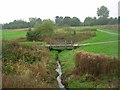
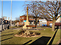
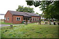
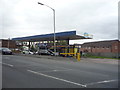
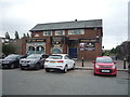
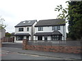
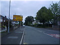
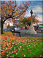
32 photos from this area
Area Information
Key information about the BL9 8LJ including its size, population, and administrative classification.
- Area Type
- Postcode
- Area Size
- 9743 m²
- Population
- 1448
- Population Density
- 148612 people/km²
House Prices in BL9 8LJ
22
Properties
£249,480
Average Sold Price
£59,950
Lowest Price
£445,000
Highest Price
Showing 22 properties
| Address | Type | Beds | Baths | Last Sale Price | Last Sale Date | |
|---|---|---|---|---|---|---|
| 104 Sunny Bank Road, Bury, BL9 8LJ | Semi-detached | 3 | 1 | £260,000 | May 2024 | |
| 134 Sunny Bank Road, Bury, BL9 8LJ | Detached | 4 | 1 | £445,000 | May 2023 | |
| 140 Sunny Bank Road, Bury, BL9 8LJ | Detached | 3 | 1 | £380,000 | Aug 2022 | |
| 106 Sunny Bank Road, Bury, BL9 8LJ | Semi-detached | 3 | 2 | £320,000 | Jul 2022 | |
| 142 Sunny Bank Road, Bury, BL9 8LJ | Detached | 4 | 1 | £254,000 | Aug 2017 | |
| 128 Sunny Bank Road, Bury, BL9 8LJ | Detached | 4 | - | £230,000 | Jun 2017 | |
| 118 Sunny Bank Road, Bury, BL9 8LJ | Detached | 4 | 1 | £256,000 | May 2016 | |
| 120 Sunny Bank Road, Bury, BL9 8LJ | Detached | - | - | £220,000 | May 2008 | |
| 116 Sunny Bank Road, Bury, BL9 8LJ | house | - | - | £69,850 | Oct 1999 | |
| 114 Sunny Bank Road, Bury, BL9 8LJ | Semi-detached | - | - | £59,950 | Feb 1998 |
Page 1 of 3
Energy Efficiency in BL9 8LJ
Amenities
Schools
| Rank | School | Type | Entry gender | Ages |
|---|
Explore more schools in this area
Go to Schools tabDemographics
Household Size
Family (3-5 people)
most common
Accommodation Type
Houses
most common
Tenure
88
majority
Ethnic Group
White
most common
Religion
N/A
most common
Household Composition
N/A
most common
Age
47
median
Adults (30-64 years)
most common
Household Deprivation
N/A
with no deprivation
NS-SEC
41
in Lower managerial occupations
Explore more demographic insights in this area
Go to Demographics tabPlanning
Planning Constraints
- Flood RiskPremium
- Ramsar Wetland SitesPremium
- Area of Outstanding Natural BeautyPremium
- Protected Nature ReservePremium
- Protected WoodlandPremium