Area Overview for BL9 8JS
Photos of BL9 8JS
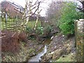
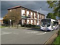
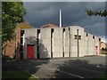
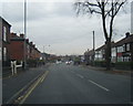
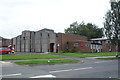
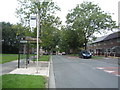
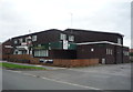
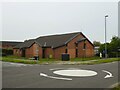
21 photos from this area
Area Information
Key information about the BL9 8JS including its size, population, and administrative classification.
- Area Type
- Postcode
- Area Size
- 7390 m²
- Population
- 1272
- Population Density
- 2994 people/km²
House Prices in BL9 8JS
20
Properties
£139,817
Average Sold Price
£900
Lowest Price
£229,000
Highest Price
Showing 20 properties
| Address | Type | Beds | Baths | Last Sale Price | Last Sale Date | |
|---|---|---|---|---|---|---|
| 208 Parr Lane, Bury, BL9 8JS | Terraced | 3 | 1 | £205,000 | Aug 2025 | |
| 190 Parr Lane, Bury, BL9 8JS | Terraced | 2 | 1 | £215,000 | May 2025 | |
| 192 Parr Lane, Bury, BL9 8JS | Terraced | 2 | 1 | £205,000 | Jan 2023 | |
| 202 Parr Lane, Bury, BL9 8JS | house | - | - | £900 | Aug 2019 | |
| 200 Parr Lane, Bury, BL9 8JS | Terraced | 3 | 1 | £162,000 | Feb 2019 | |
| 194 Parr Lane, Bury, BL9 8JS | Terraced | 2 | - | £128,000 | Mar 2016 | |
| 216 Parr Lane, Bury, BL9 8JS | Semi-detached | 4 | 3 | £135,000 | Feb 2014 | |
| 210 Parr Lane, Bury, BL9 8JS | house | 4 | - | £170,000 | Jan 2012 | |
| 220 Parr Lane, Bury, BL9 8JS | Semi-detached | - | - | £229,000 | Apr 2005 | |
| 204 Parr Lane, Bury, BL9 8JS | Terraced | - | - | £64,950 | Sep 2002 |
Page 1 of 2
Energy Efficiency in BL9 8JS
Amenities
Schools
| Rank | School | Type | Entry gender | Ages |
|---|
Explore more schools in this area
Go to Schools tabDemographics
Household Size
One person
most common
Accommodation Type
Houses
most common
Tenure
87
majority
Ethnic Group
White
most common
Religion
N/A
most common
Household Composition
N/A
most common
Age
47
median
Adults (30-64 years)
most common
Household Deprivation
N/A
with no deprivation
NS-SEC
38
in Lower managerial occupations
Explore more demographic insights in this area
Go to Demographics tabPlanning
Planning Constraints
- Flood RiskPremium
- Ramsar Wetland SitesPremium
- Area of Outstanding Natural BeautyPremium
- Protected Nature ReservePremium
- Protected WoodlandPremium