Area Overview for BL9 8GZ
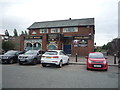
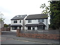
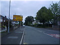
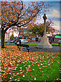
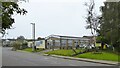
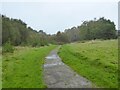
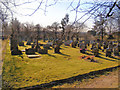
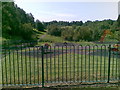
Photos of BL9 8GZ
Area Information
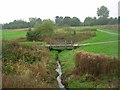
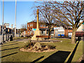
Living in BL9 8GZ means being part of a small, tightly knit residential cluster in Unsworth, a village in the Metropolitan Borough of Bury, Greater Manchester. The area covers 972 acres of land that was once boggy arable fields, now shaped by post-1950s urban development. With a population of 1,272, it is a quiet, low-density community positioned between Parr Brook and Whittle Brook, near the A56 road linking Bury and Manchester. Historically tied to Lancashire, Unsworth has roots in medieval iron smelting and 19th-century industrial activity, including dye and cotton mills. Today, its character is defined by housing built in the mid-20th century, with Sunny Bank Road connecting to major transport routes. Residents benefit from proximity to nearby towns like Whitefield and Radcliffe, while the area retains a sense of local identity. This is a place where daily life revolves around community, with schools, shops, and transport links within practical reach, offering a balance of convenience and tranquility.
- Area Type
- Postcode
- Area Size
- Not available
- Population
- 1272
- Population Density
- 2994 people/km²
The property market in BL9 8GZ is characterised by high home ownership (87%) and a focus on houses rather than flats or apartments. This suggests a market skewed towards owner-occupied homes, with limited rental activity. The area’s small size and cluster of residences mean housing stock is likely to be limited, with fewer new developments compared to larger urban centres. For buyers, this implies competition for available properties, particularly family homes suited to the area’s demographic of adults aged 30-64. The predominance of houses may appeal to those seeking space and privacy, though the lack of high-density housing could limit options for those prioritising affordability or proximity to city centres. Proximity to the A56 and nearby towns like Bury and Manchester may enhance the area’s appeal, offering a blend of local living with access to regional amenities.
House Prices in BL9 8GZ
No properties found in this postcode.
Energy Efficiency in BL9 8GZ
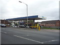
Life in BL9 8GZ is supported by a range of nearby amenities, from retail to transport hubs. The area’s shops include Co-op Parr, Spar, and Asda Blackford, providing essentials within easy reach. Metro areas like Whitefield, Besses o’th’barn, and Radcliffe offer additional shopping and dining options. Rail stations at Clifton, Swinton, and Kearsley connect residents to broader regional networks, while the Chorlton Street Coach Station adds local bus access. The presence of schools, combined with proximity to green spaces and historical sites, suggests a balance of practicality and local character. The area’s small size means amenities are compact but sufficient for daily needs, fostering a sense of convenience without the sprawl of larger towns. Residents benefit from a mix of modern services and traditional infrastructure, supporting both independent living and community engagement.
Amenities
Schools
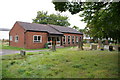
Residents of BL9 8GZ have access to a range of schools, including Unsworth Primary School, Bury and Whitefield Jewish Primary School (rated ‘good’ by Ofsted), Castlebrook High School, and Unsworth Academy (also rated ‘good’). The presence of both primary and secondary options, including an academy, provides families with choice in education. The Bury and Whitefield Jewish Primary School’s ‘good’ rating indicates a school with strong performance in key areas such as pupil outcomes and teaching quality. Unsworth Academy’s ‘good’ rating further reinforces the area’s commitment to educational standards. The mix of school types, including faith-based and mainstream institutions, allows families to select options aligned with their values or needs. For parents, this diversity ensures coverage from early years through to secondary education, reducing the need for long commutes to schools outside the area.
| Rank | School | Type | Entry gender | Ages |
|---|
Explore more schools in this area
Go to Schools tabDemographics
BL9 8GZ is home to a population of 1,272, with a median age of 47 and the majority of residents falling within the 30-64 age range. This suggests a community of working-age adults, many of whom are likely to be settled in long-term housing. Home ownership is high, with 87% of residents owning their homes, indicating a stable, established demographic. The accommodation type is predominantly houses, reflecting a residential area with fewer high-density developments. The predominant ethnic group is White, which aligns with broader trends in the region. While no specific data on deprivation or diversity beyond ethnicity is provided, the high home ownership rate and age profile suggest a community focused on family living and long-term investment. The absence of detailed diversity metrics means the area’s social composition remains less defined in the data, but the presence of schools with varying educational focuses hints at a range of family needs being met.
Household Size
Accommodation Type
Tenure
Ethnic Group
Religion
Household Composition
Age
Household Deprivation
NS-SEC
Explore more demographic insights in this area
Go to Demographics tabPlanning
Planning Constraints
- Flood RiskPremium
- Ramsar Wetland SitesPremium
- Area of Outstanding Natural BeautyPremium
- Protected Nature ReservePremium
- Protected WoodlandPremium