Area Overview for BL9 8FP
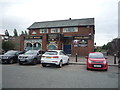
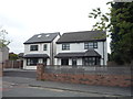
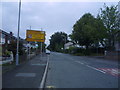
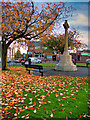
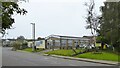
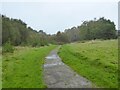
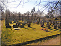
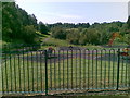
Photos of BL9 8FP
Area Information
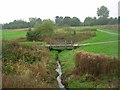
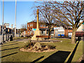
BL9 8FP lies in the village of Unsworth, part of the Metropolitan Borough of Bury in Greater Manchester. This small residential cluster, with a population of 1,272, sits on high ground between Parr Brook and Whittle Brook, historically arable land transformed by post-1950s housing development. Its proximity to the A56, linking Bury and Manchester, ensures easy access to urban centres. Unsworth’s character blends rural tranquillity with suburban convenience, shaped by its medieval roots and industrial past. The area’s compact size fosters a close-knit community, with Sunny Bank Road serving as a key link to regional transport networks. For those seeking a balance between countryside and city, BL9 8FP offers a distinct identity, rooted in local history yet connected to modern infrastructure. Its schools, amenities, and transport options cater to families and professionals alike, making it a practical choice for those prioritising stability and accessibility.
- Area Type
- Postcode
- Area Size
- Not available
- Population
- 1272
- Population Density
- 2994 people/km²
BL9 8FP is primarily an owner-occupied area, with 87% of homes owned by residents rather than rented. The accommodation type is predominantly houses, which contrasts with areas where flats or apartments dominate. This suggests a community focused on family homes and long-term residency, rather than transient rental markets. The small area’s housing stock is likely limited in scale, with properties concentrated in a compact residential cluster. For buyers, this means a limited selection of homes, potentially driving competition among local residents. The absence of high-rise or multi-unit developments indicates a quieter, more private living environment. However, the small size of the area may also mean that property values are influenced by proximity to nearby towns like Bury or Manchester, where more extensive housing options exist.
House Prices in BL9 8FP
No properties found in this postcode.
Energy Efficiency in BL9 8FP
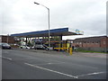
Residents of BL9 8FP enjoy a range of nearby amenities, including five retail outlets such as Co-op Parr, Spar, and Asda Blackford, ensuring everyday shopping needs are met. The area’s proximity to metro hubs like Whitefield and Besses o’th’barn offers additional commercial and leisure options. Rail stations at Clifton, Swinton, and Kearsley provide easy access to regional transport networks, while the Chorlton Street Coach Station connects to local bus routes. The presence of multiple schools and the A56 road link further enhance the area’s practicality. For leisure, the surrounding countryside and historical sites, such as Unsworth Moss, offer opportunities for walking or recreation. The mix of retail, transport, and educational facilities creates a convenient lifestyle, blending suburban comfort with urban connectivity.
Amenities
Schools
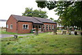
Residents of BL9 8FP have access to several schools, including Unsworth Primary School, Bury and Whitefield Jewish Primary School (rated ‘good’ by Ofsted), Castlebrook High School, and Unsworth Academy (also ‘good’). The presence of both primary and academy schools offers families a range of educational options, from early years to secondary education. The ‘good’ Ofsted ratings suggest these institutions meet or exceed national standards in teaching quality and student outcomes. The duplication of Unsworth Primary School in the data may reflect a local emphasis on primary education, with multiple schools serving the area. For parents, this diversity of choices can be advantageous, allowing them to select a school aligned with their child’s needs or the family’s priorities. The absence of secondary schools listed may mean students travel to nearby towns for higher education.
| Rank | School | Type | Entry gender | Ages |
|---|
Explore more schools in this area
Go to Schools tabDemographics
The population of BL9 8FP has a median age of 47, with the majority of residents aged 30–64. This suggests a community skewed towards adults in their prime working and family-raising years. Home ownership is high at 87%, indicating a stable, long-term resident base. The area is predominantly composed of houses rather than flats, reflecting a preference for standalone properties. The predominant ethnic group is White, with no specific data on other demographics provided. The age profile implies a mix of established families and older adults, though younger households are less represented. This demographic structure likely influences local services and amenities, with schools and retail tailored to adult and family needs. The absence of detailed diversity data means broader cultural or social dynamics remain unexplored in this analysis.
Household Size
Accommodation Type
Tenure
Ethnic Group
Religion
Household Composition
Age
Household Deprivation
NS-SEC
Explore more demographic insights in this area
Go to Demographics tabPlanning
Planning Constraints
- Flood RiskPremium
- Ramsar Wetland SitesPremium
- Area of Outstanding Natural BeautyPremium
- Protected Nature ReservePremium
- Protected WoodlandPremium